Sold For $250
*Includes Buyers Premium
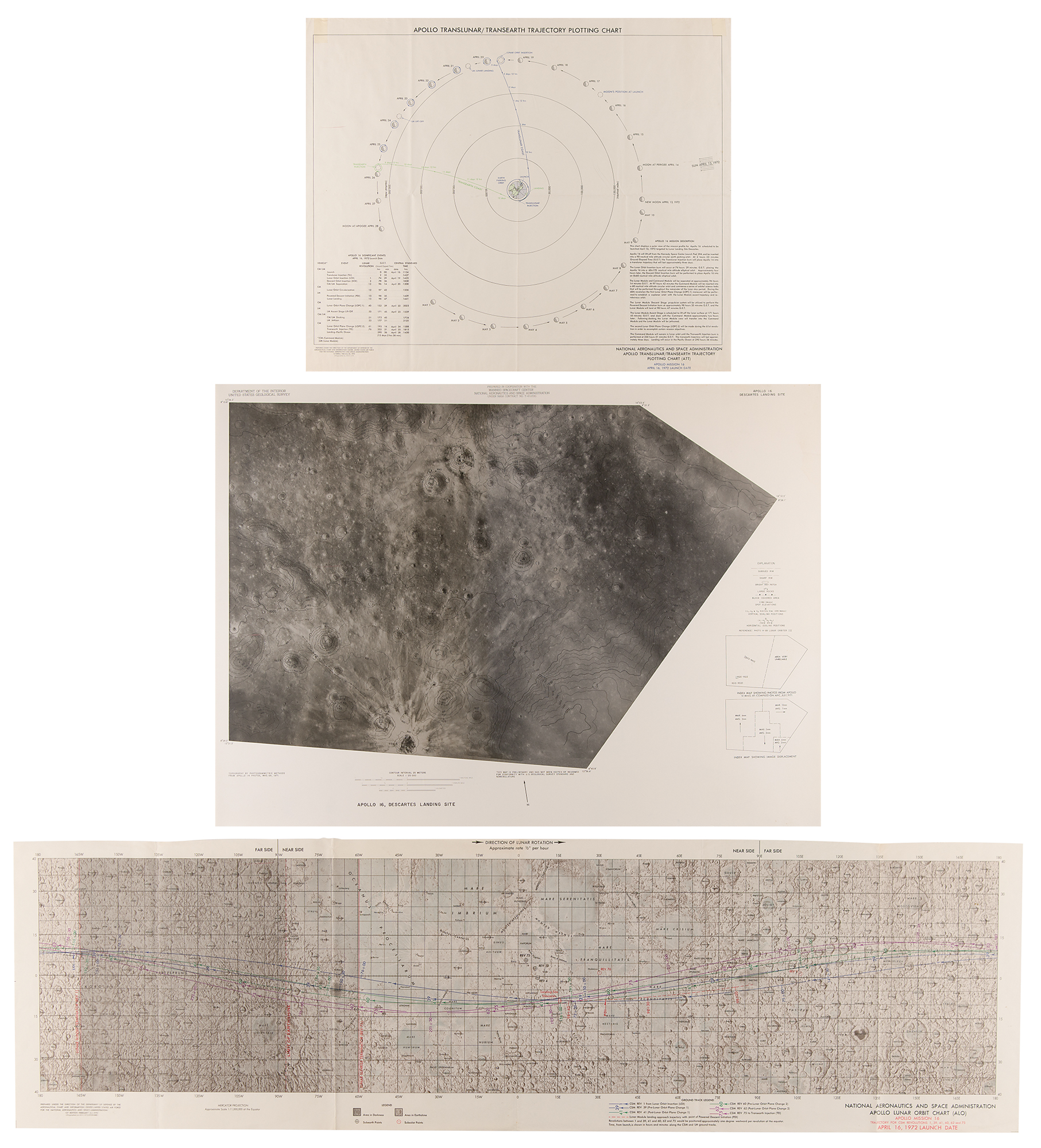
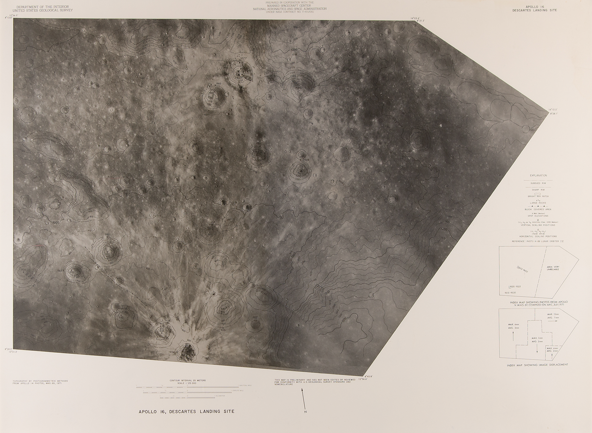
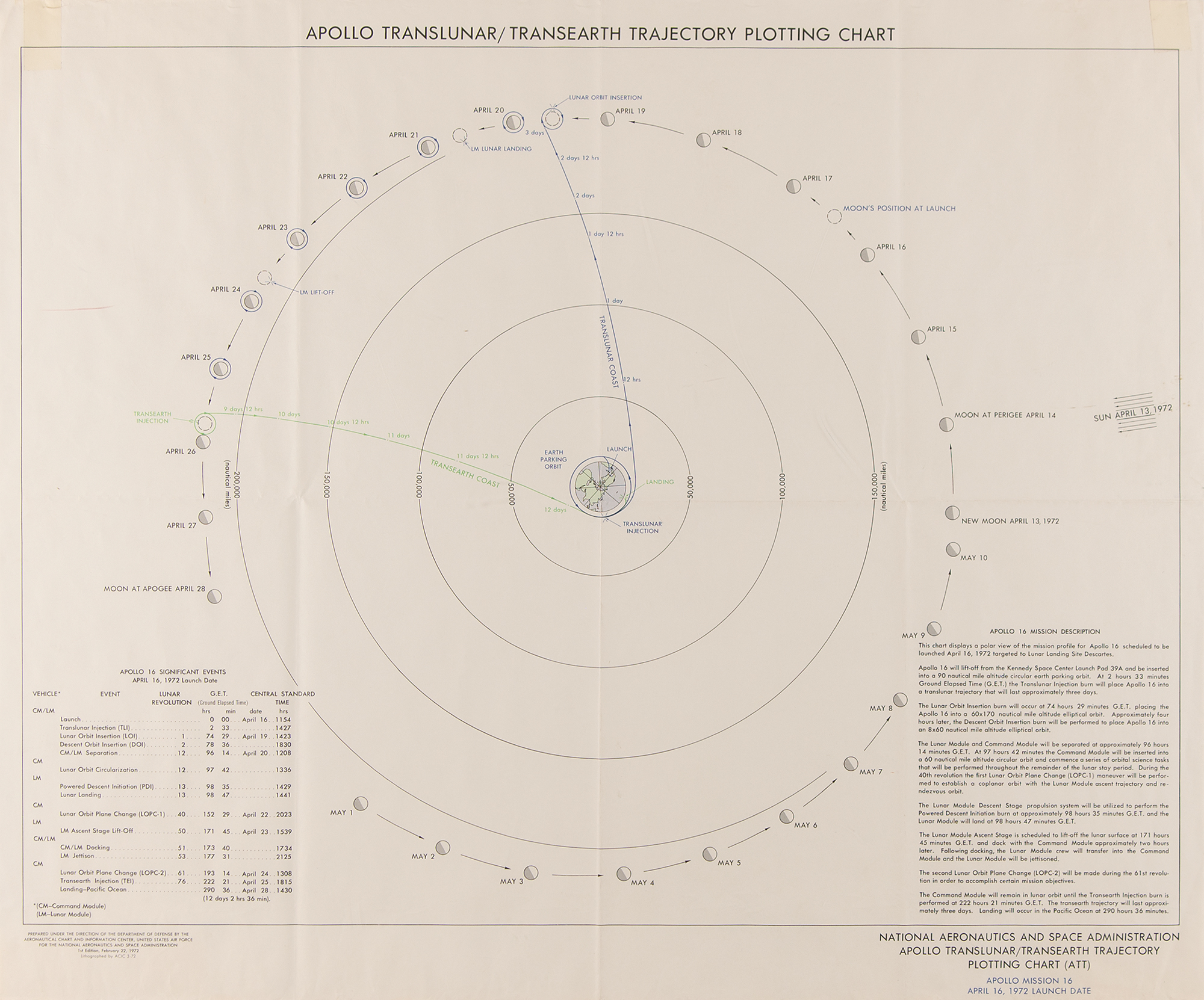
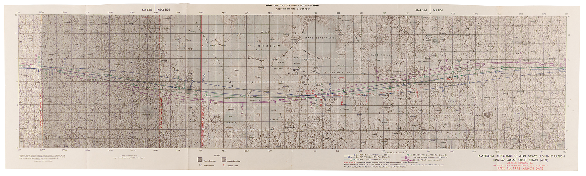
Three items: a semi-glossy 1:25,000 photo map of the “Apollo 16 Descartes Landing Site,” 34 x 25, prepared by the Department of the Interior, U.S. Geological Survey, in cooperation with NASA’s Manned Spacecraft Center; a color 1:11,000,000 first edition of the Apollo Lunar Orbit Chart for the Apollo 16 mission, 41 x 12, containing trajectories for CSM revolutions 1, 39, 41, 60, 62, and 75, dated February 16, 1972; and a color first edition Apollo Translunar/Transearth Trajectory Plotting Chart for the Apollo 16 mission, 24 x 20, dated February 22, 1972, which shows a polar view of of the mission profile for Apollo 16. In overall fine condition, with tape remnants to the upper corners of the ATT chart.

This item is Pre-Certified by STEVE ZARELLI
Buy a third-party letter of authenticity for
(inquire for price)
*This item has been pre-certified by a trusted third-party authentication service, and by placing a bid on this item, you agree to accept the opinion of this authentication service. If you wish to have an opinion rendered by a different authenticator of your choosing, you must do so prior to your placing of any bid. RR Auction is not responsible for differing opinions submitted 30 days after the date of the sale.
Third-party authentication service applies only to signatures and handwriting, and does not cover the addition of sketches, artwork, musical quotations, etc.