Sold For $250
*Includes Buyers Premium
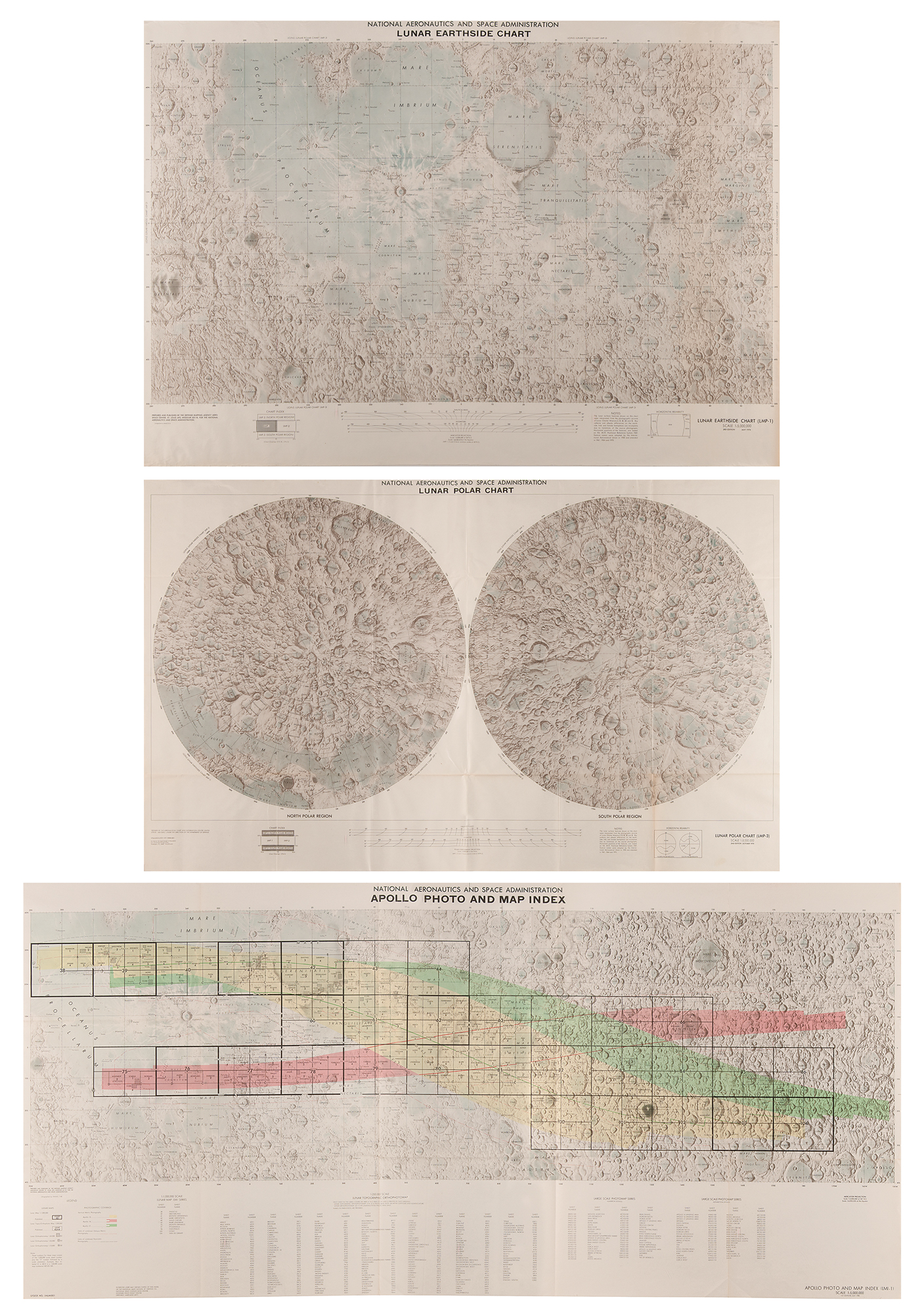
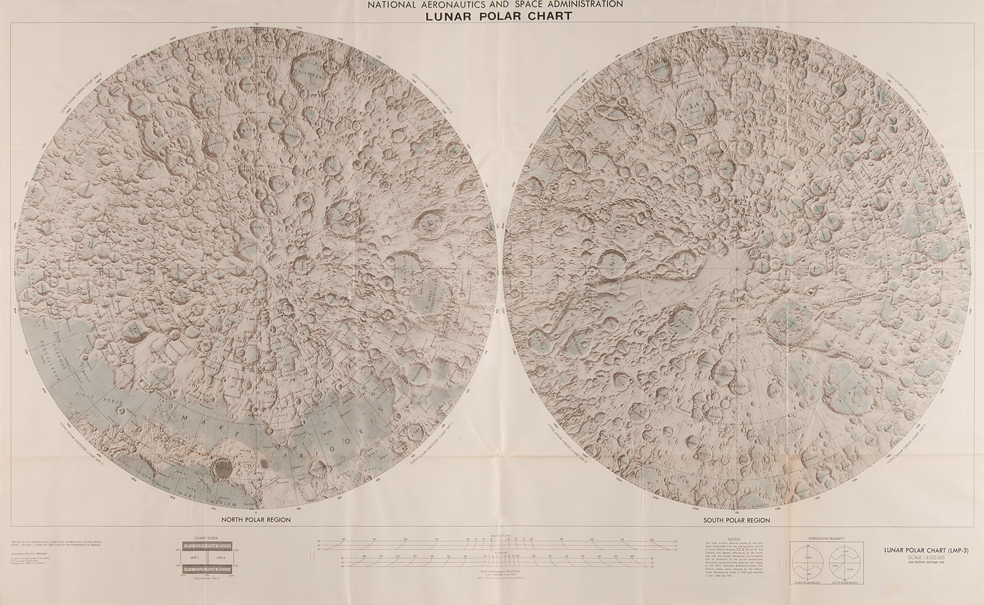
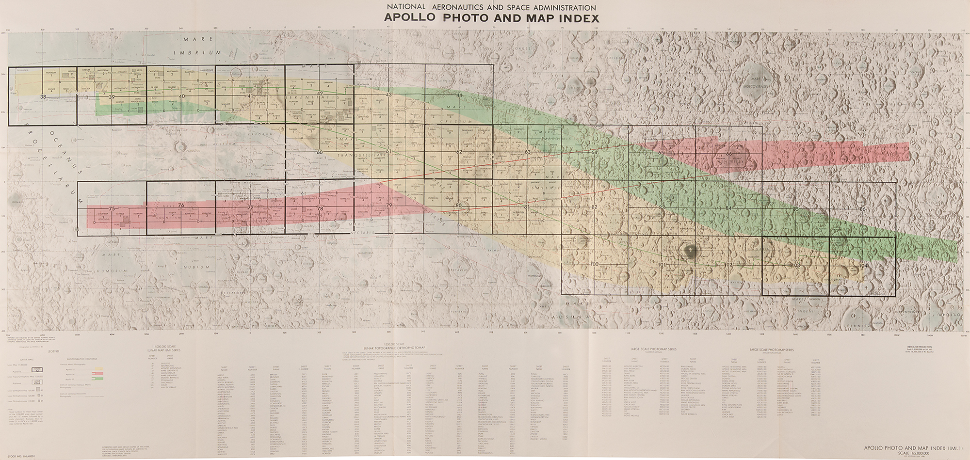
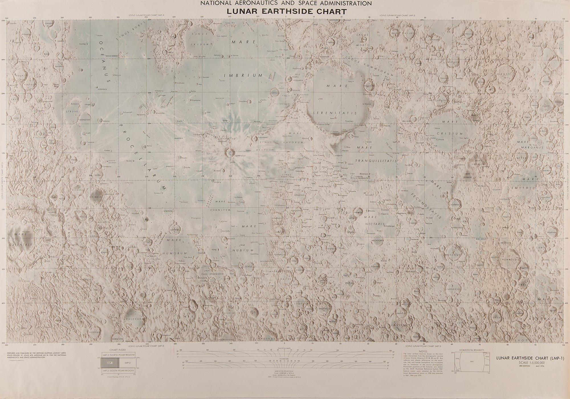
Three large NASA charts related to the Apollo moon-landing program: a third edition color 1:5,000,000 scale Lunar Earthside Chart (LMP-1), dated May 1976, 40.5 x 28.5, which prominently shows the Apollo 11 ‘Sea of Tranquility’ landing site, with notes section reading: “The lunar surface features shown on this chart were interpreted from the photographic records of Lunar Orbiter Missions I, II, III, IV, and V”; second edition color 1:5,000,000 scale Lunar Polar Chart (LMP-3), dated October 1970, 47 x 28.5, which shows large views of the moon’s north and south polar regions, which respectively join the Lunar Earthside and Lunar Farside charts; and a first edition color 1:5,000,000 scale Apollo Photo and Map Index chart (LMI-1), dated July 1980, 56.5 x 26.75, which lists sheet names and numbers for numerous lunar features, as ordered by the Lunar Topographic Orthophotomap and the Lunar Orthophotomap. In overall fine condition.

This item is Pre-Certified by STEVE ZARELLI
Buy a third-party letter of authenticity for
(inquire for price)
*This item has been pre-certified by a trusted third-party authentication service, and by placing a bid on this item, you agree to accept the opinion of this authentication service. If you wish to have an opinion rendered by a different authenticator of your choosing, you must do so prior to your placing of any bid. RR Auction is not responsible for differing opinions submitted 30 days after the date of the sale.
Third-party authentication service applies only to signatures and handwriting, and does not cover the addition of sketches, artwork, musical quotations, etc.