The 30 Minute Rule begins November 19 at 7:00 PM EST. An Initial Bid Must Be Placed By November 19 at 6:00 PM EST To Participate After 6:00 PM EST
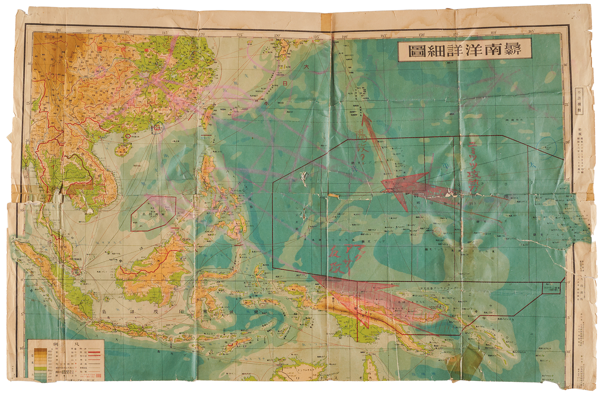
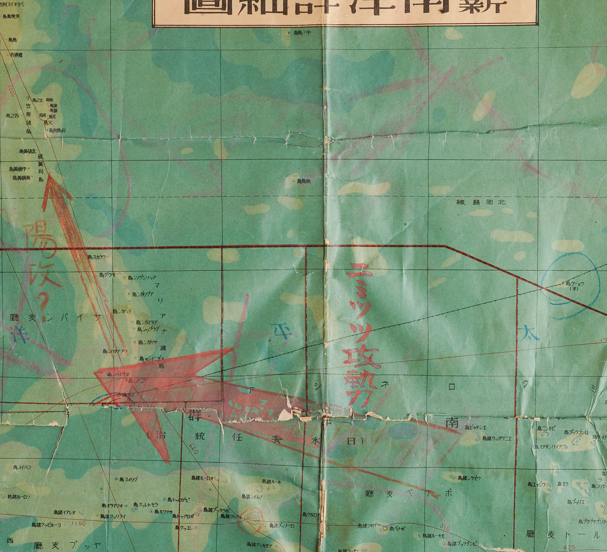
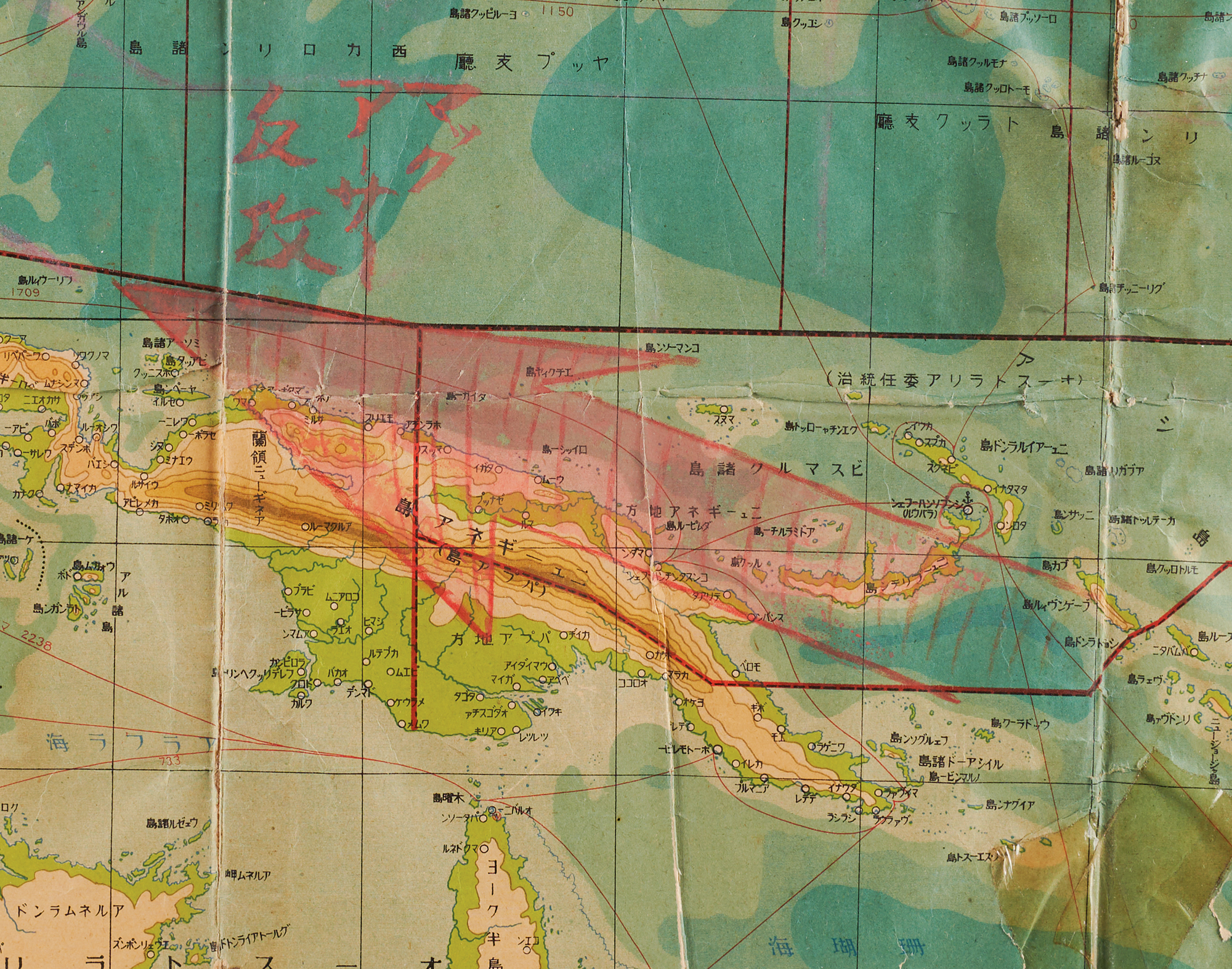
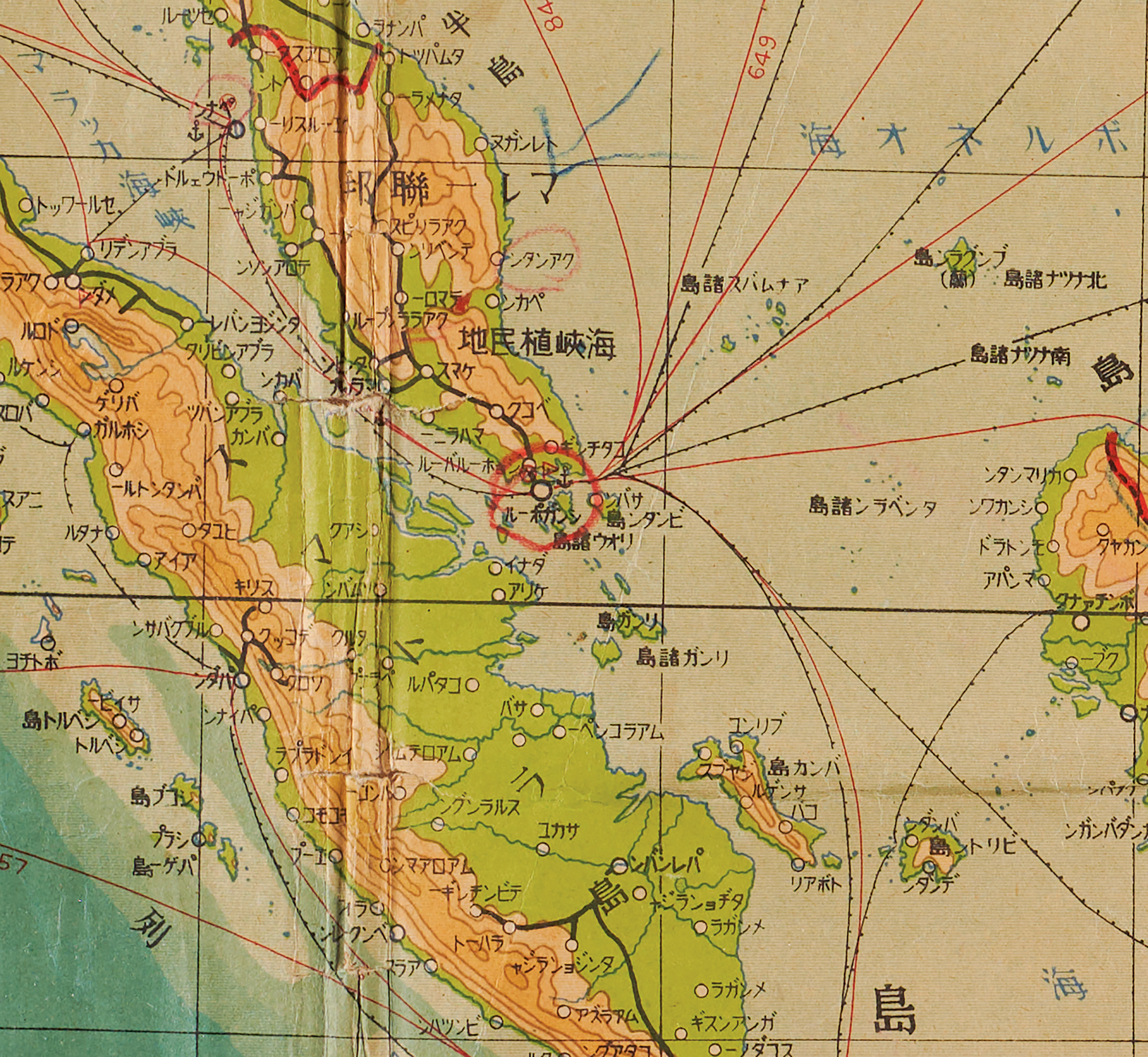
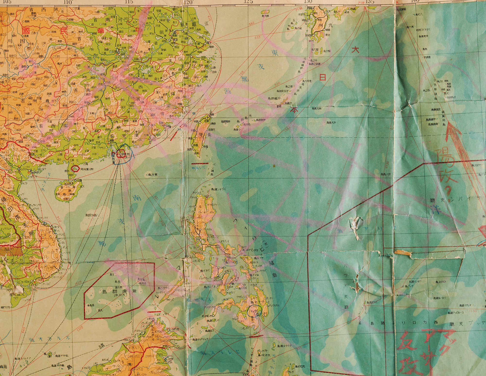
Original World War II-dated Japanese map of the South Seas, "最新南洋詳細圖" (Newest Detailed Map of the South Seas), 30.75 x 19.75, first edition, printed March 25 and published March 30, 1941, by Nihon Tōsei Chizu Kabushiki Kaisha, Tokyo, with copyright held by Kudan Shobō, marked "不許複製" (reproduction prohibited). The color map covers the Western Pacific from Burma, French Indochina, and South China east to Kyushu and Wake Island, and south through the Philippines, the Dutch East Indies, New Guinea, and the Solomons, with a legend identifying railways, shipping routes, submarine cables, wireless stations, main ports, and Japanese diplomatic posts. Printed boundaries mark Japan’s South Seas Mandate and the territory recently ceded by French Indochina to Thailand. The map has been annotated in red, pink, and blue crayon to chart the expected American advance across the Pacific: a broad red arrow rising from New Guinea, labeled "マッカーサー反攻" (MacArthur counteroffensive); a second sweeping northwest through the Caroline Islands, labeled "ニミッツ攻勢" (Nimitz offensive); and a narrower arrow running north from the Marianas toward Iwo Jima, labeled "陽攻". Further markings include lines across the China coast, arrows near the Ryukyu Islands, and circles around Wake Island and several points in the Philippines and South China.
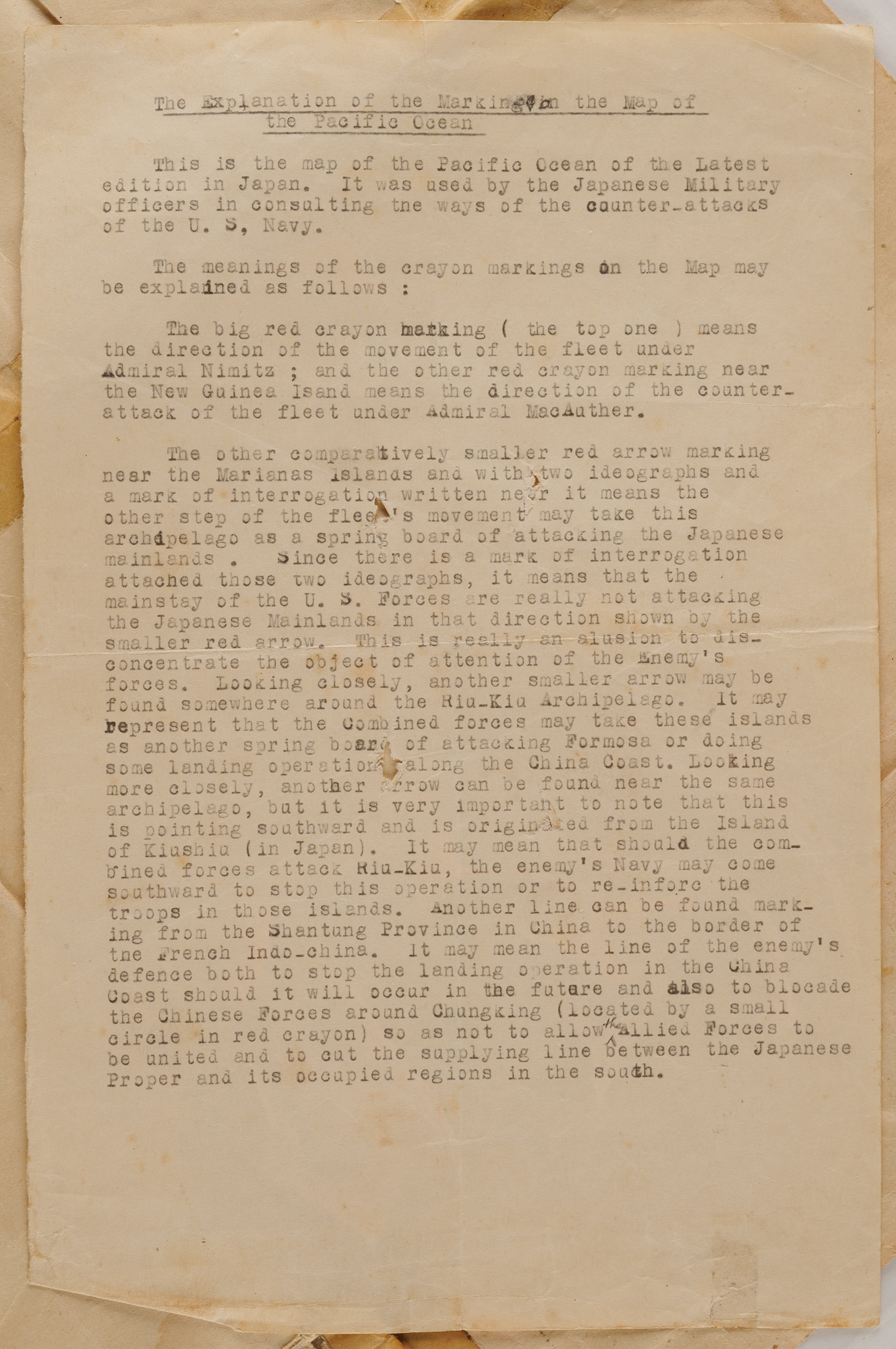
Accompanied by a typed sheet, entitled “The Explanation of the Marking in the Map of the Pacific Ocean,” interpreting the annotations, in part: “This is the map of the Pacific Ocean of the Latest edition in Japan. It was used by the Japanese Military officers in consulting the ways of the counter-attacks of the U. S, Navy…The big red crayon marking ( the top one ) means the direction of the movement of the fleet under Admiral Nimitz ; and the other red crayon marking near the New Guinea Isand [sic] means the direction of the counter-attack of the fleet under Admiral MacAuther [sic]…Since there is a mark of interrogation attached those two ideographs, it means that the mainstay of the U. S. Forces are really not attacking the Japanese Mainlands in that direction shown by the smaller red arrow. This is really an alusion [sic] to dis-concentrate the object of attention of the Enemy’s forces.”
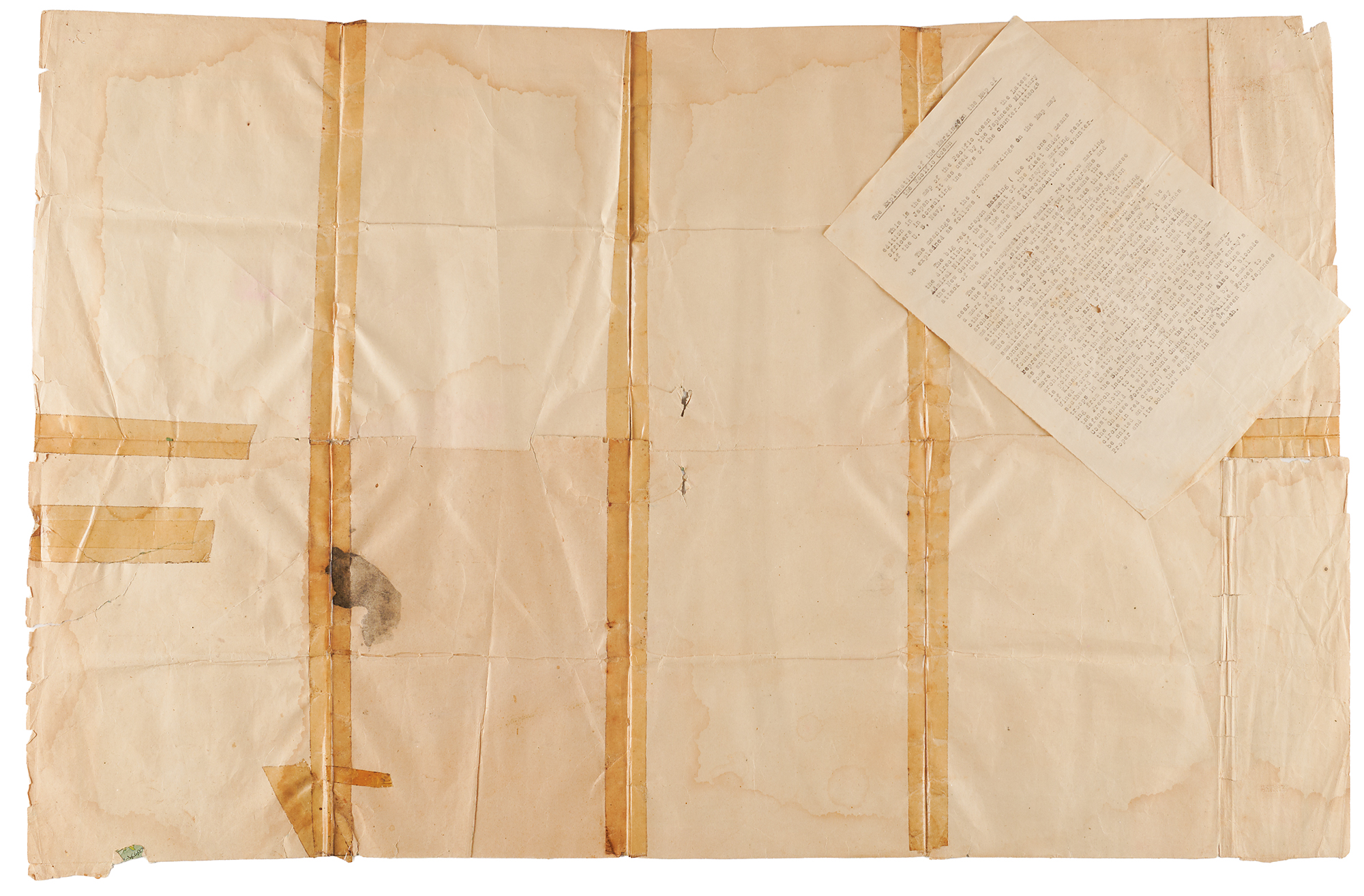
Housed together in a protective plastic sleeve. In very good condition, with toning, dampstaining, and overall wear, including paper loss, tape-repaired tears, and separations along folds.
Published more than eight months before Pearl Harbor, this map depicts the region into which Japan would soon expand, while its annotations reflect the later Allied counteroffensive. The two principal arrows correspond broadly to the complementary advances that pressed Japan’s defensive perimeter from widely separated directions: General Douglas MacArthur’s campaign along New Guinea toward the Philippines, and Admiral Chester Nimitz’s drive across the Central Pacific, shown here passing through the Carolines. This dual strategy, underway from late 1943, divided Japanese defenses and complicated efforts to anticipate the next Allied landing.
A separate, narrower arrow runs north from the Marianas toward Iwo Jima, marked "陽攻?" (feint attack?), suggesting an attempt to judge whether that route represented a diversion or a principal thrust toward Japan. The Marianas and Iwo Jima became major American objectives: U.S. forces landed on Saipan on June 15, 1944, and the Marianas became the base for B-29 raids on Japan, while Iwo Jima, lying along the bombers’ route to Tokyo, was invaded by U.S. Marines on February 19, 1945.
The accompanying explanation attributes the markings to Japanese military officers, but their authorship and date remain unverified. The sheet itself refers to Japan’s fleet as “the enemy’s Navy” and to the Allies as “the Combined forces,” suggesting it was written from the Allied side.

