The 30 Minute Rule begins November 19 at 7:00 PM EST. An Initial Bid Must Be Placed By November 19 at 6:00 PM EST To Participate After 6:00 PM EST
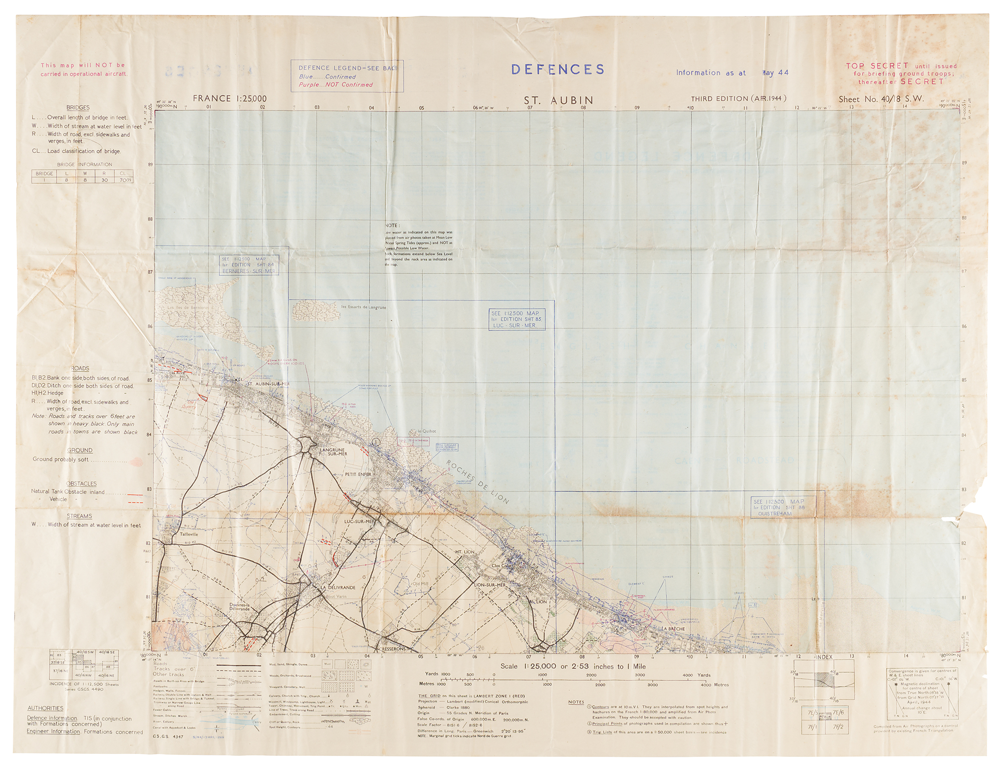
British military defense map of the Normandy coast, 28 x 21.5, titled “Defences, St. Aubin,” sheet number 40/18 S.W., issued at a scale of 1:25,000 as part of the G.S.G.S. 4347 series. Identified as the third edition of April 1944, with defense information updated to May 1944. Printed red security warnings read: “Top Secret until issued for briefing ground troops; thereafter Secret” and “This map will not be carried in operational aircraft.”
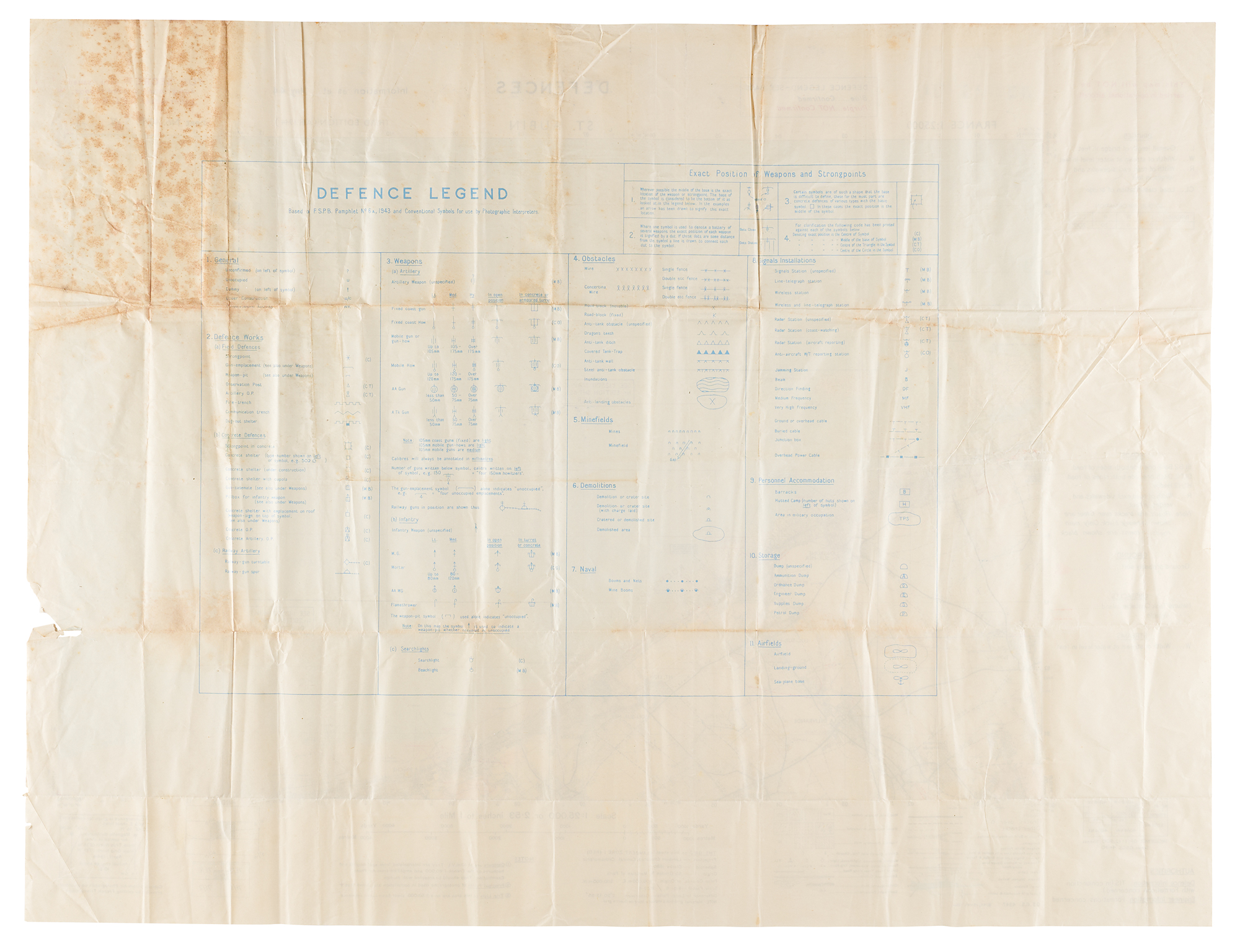
The map covers St. Aubin-sur-Mer, Langrune-sur-Mer, Luc-sur-Mer, Lion-sur-Mer, and the surrounding countryside, detailing coastal gun positions, fortified buildings, beach obstacles, minefields, radar installations, and inland roads. Blue markings identify confirmed defenses, while purple indicates unconfirmed information. Notations describe bricked-up windows, fortified houses, hedgehog obstacles, stakes, and rooftop antiaircraft guns at 100-yard intervals. The reverse bears an extensive “Defence Legend” explaining symbols for weapons, field and concrete defenses, obstacles, minefields, demolitions, naval barriers, communications installations, storage facilities, and airfields. In very good condition, with intersecting folds, overall creasing, tears to edges, and areas of scattered staining.
The mapped coastline includes St. Aubin-sur-Mer at the eastern end of Juno Beach and extends eastward into the Sword Beach area. On June 6, 1944, British No. 48 (Royal Marine) Commando landed at St. Aubin in Juno’s Nan Red sector and advanced toward Langrune-sur-Mer, tasked with assaulting the strongpoint there and linking up with No. 41 (Royal Marine) Commando, coming west from Sword, with the aim of closing the gap between the Canadian and British beachheads. Langrune was defended by a large anti-tank wall and the strongpoint designated Wn 26, manned by the 9th Company of Grenadier-Regiment 736. The commandos suffered heavy casualties during the landing and the subsequent fighting at Langrune, while 41 Commando was held up at Lion-sur-Mer, and the planned junction was not made that day. The German strongpoint at Langrune held out until the afternoon of June 7, when its garrison surrendered following a renewed assault supported by armored vehicles. That evening, 41 Commando made contact with No. 46 (Royal Marine) Commando at Luc-sur-Mer, joining the two beachheads. Commando units later contained and, on June 17, captured the German radar station at Douvres-la-Délivrande. Maps of this kind remained in use as the campaign moved inland: in its account of an action near Dozulé in August 1944, 48 Commando’s war diary cites as its reference a 1/25,000 sheet, No 40/16 NE, numbered in the same system as this map.

