Sold For $656
*Includes Buyers Premium
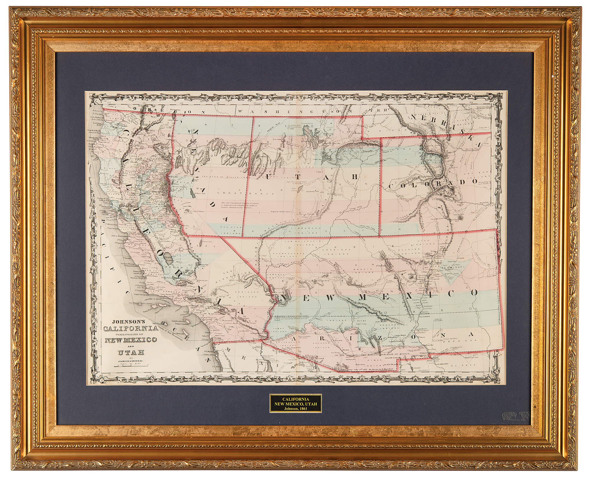
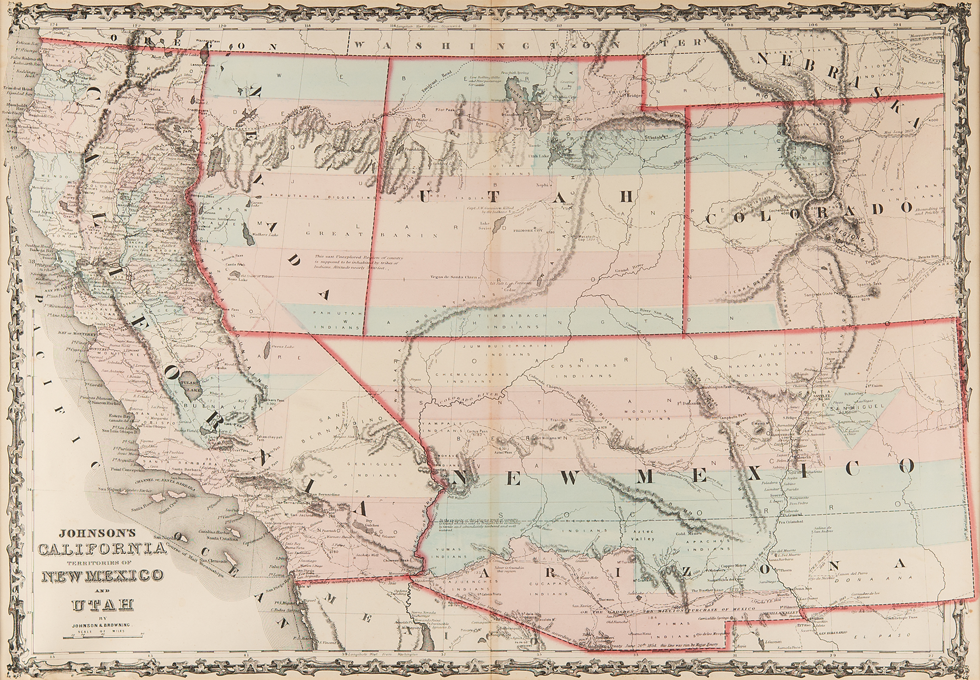
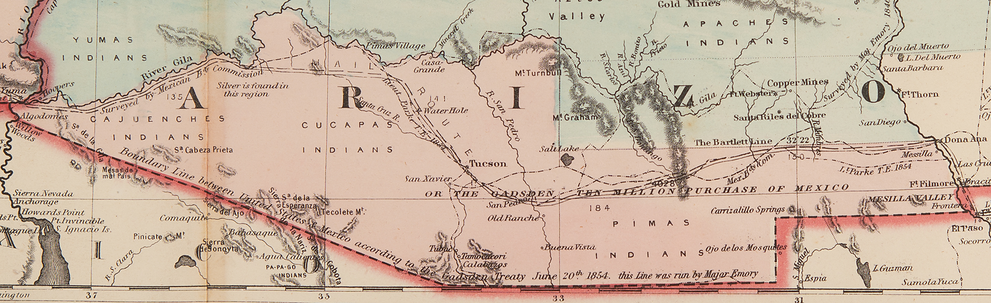
Beautiful hand-colored steel-engraved map of “Johnson’s California, Territories of New Mexico, and Utah,” 24.5 x 17, published in 1861 by Johnson & Browning as part of ‘Johnson's New Illustrated (Steel Plate) Family Atlas, with Descriptions, Geographical, Statistical, and Historical.’ This richly detailed, high-quality two-page map, which features mountain ranges, rivers, major trails, and settlements, captures a transitional period in American territorial development, before Arizona, Nevada, and Colorado gained full territorial status; California is shown as a state (admitted in 1850), but New Mexico and Utah were still territories. Of particular interest is newly formed Nevada, shown occupying part of California to the summit line of the Sierras, its western border extending south from Goose Lake, continuing along the Sierra Nevada Mountains, and extending east to the southern border of Utah. Also of note, Arizona appears in southern New Mexico Territory, the lower section of which contains "The Gadsden Ten Million Purchase of Mexico.” The Gold Region in Colorado's South Park is also prominently shown. Impressively matted and framed to an overall size of 33 x 27. In fine condition, with toning from tape to reverse of center line.