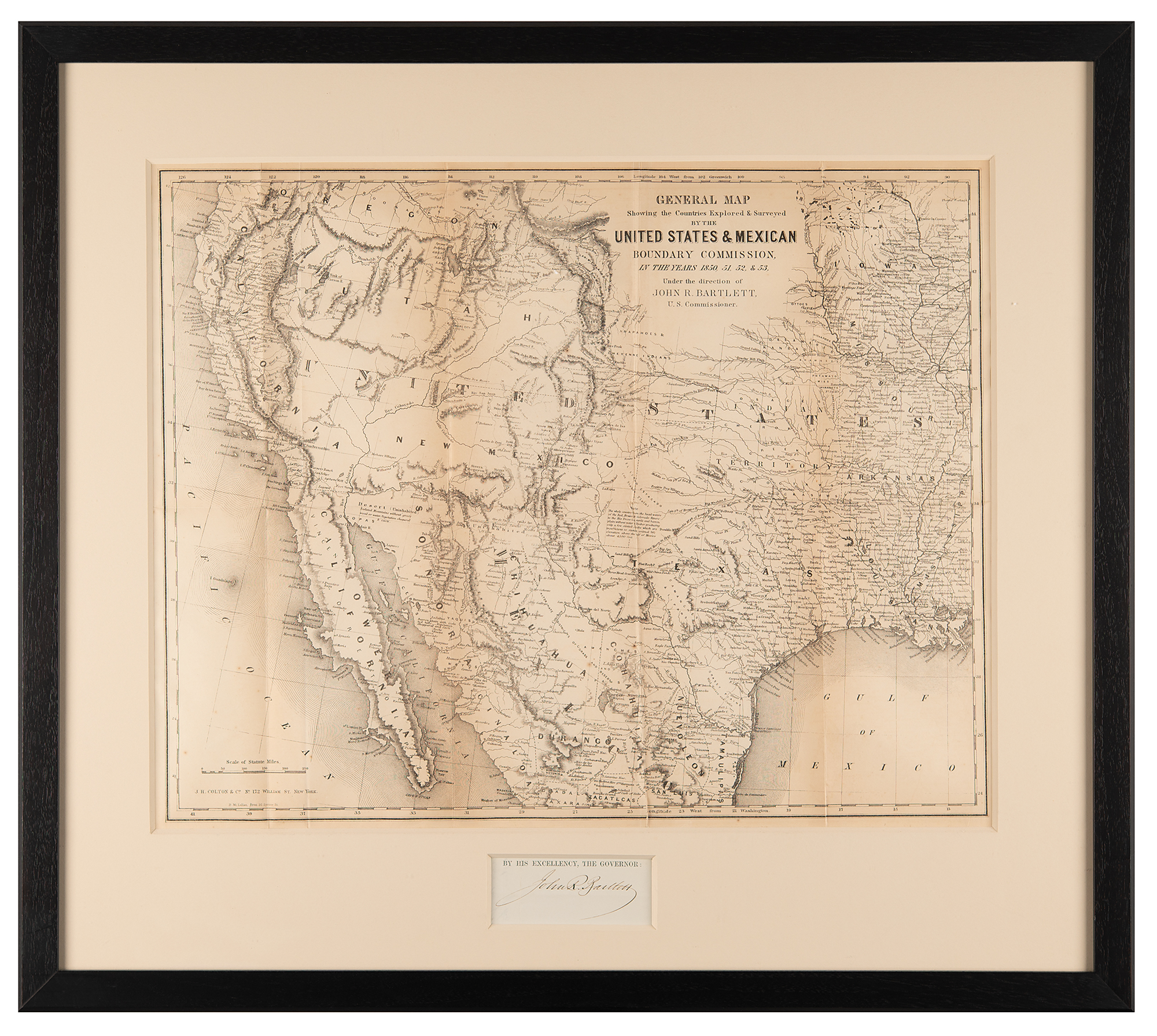
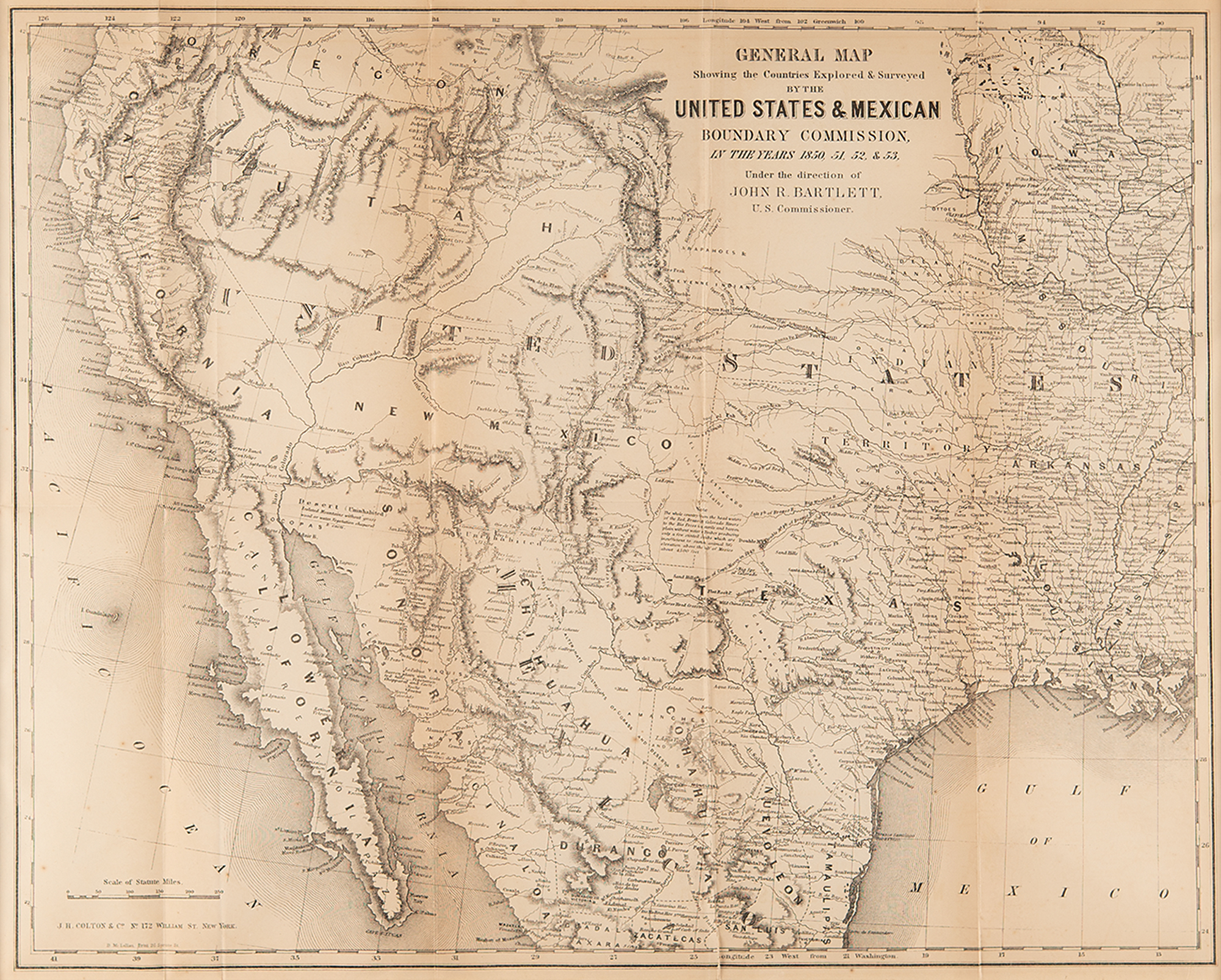
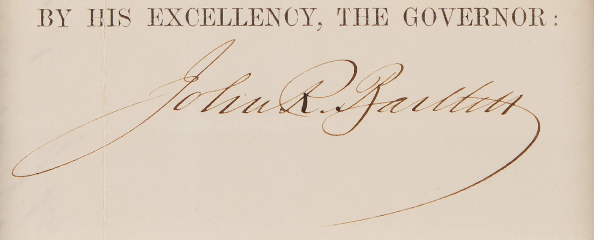
Scarce original 1854 map titled “General Map Showing the Countries Explored & Surveyed by the United States & Mexican Boundary Commission, in the Years 1850, 51, 52, & 53,” created under the direction of John R. Bartlett, U.S. Commissioner of the Boundary Commission organized under the Treaty of Guadalupe Hidalgo. Matted and framed with an ink signature of Bartlett’s to an overall size of 26.25 x 23.25. In fine condition, with light toning to the intersecting folds, as issued.
Based on four years of exploration and survey, this large-format map depicts the western United States and northern Mexico with remarkable detail, from early routes and settlements to Indian villages and topographical features. One of the first printed maps to show Jackson Lake east of the Tetons, it presents Utah in its largest territorial configuration—stretching from California eastward into present-day Kansas. Privately printed by J. H. Colton for Bartlett’s Personal Narrative of explorations and incidents in Texas, New Mexico, California, Sonora, and Chihuahua (Appleton, 1854).
Although thorough in its reach, Bartlett’s survey stirred a political firestorm. The map’s boundary decisions, particularly the starting point on the Rio Grande, failed to include the agriculturally vital Mesilla Valley in U.S. territory—an omission that alarmed both expansionists and Western officials. The chief surveyor, Andrew B. Gray, refused to certify Bartlett’s results, and the map was never officially adopted. In response, the Army’s Topographical Engineers dispatched Lt. William H. Emory to conduct a new survey, which in turn revealed further deficiencies.
The resulting territorial dispute helped spur the Gadsden Purchase of 1854, in which the United States acquired additional land from Mexico to solidify claims and ensure the feasibility of a southern transcontinental railroad. Even that agreement failed to fully solve the problem: the railroad from San Diego to Texas eventually required a right-of-way through Mexican soil. This striking and historically important map is a cartographic snapshot of the turbulent, uncertain moment when national ambition, railroads, and boundary lines collided in the desert Southwest.