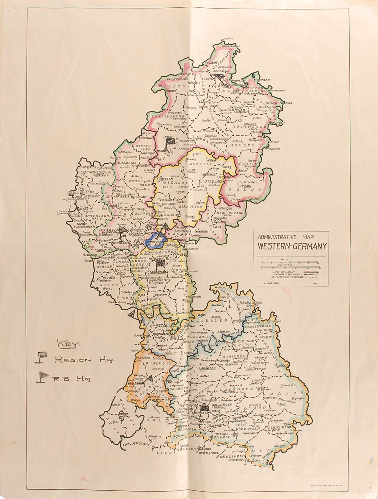
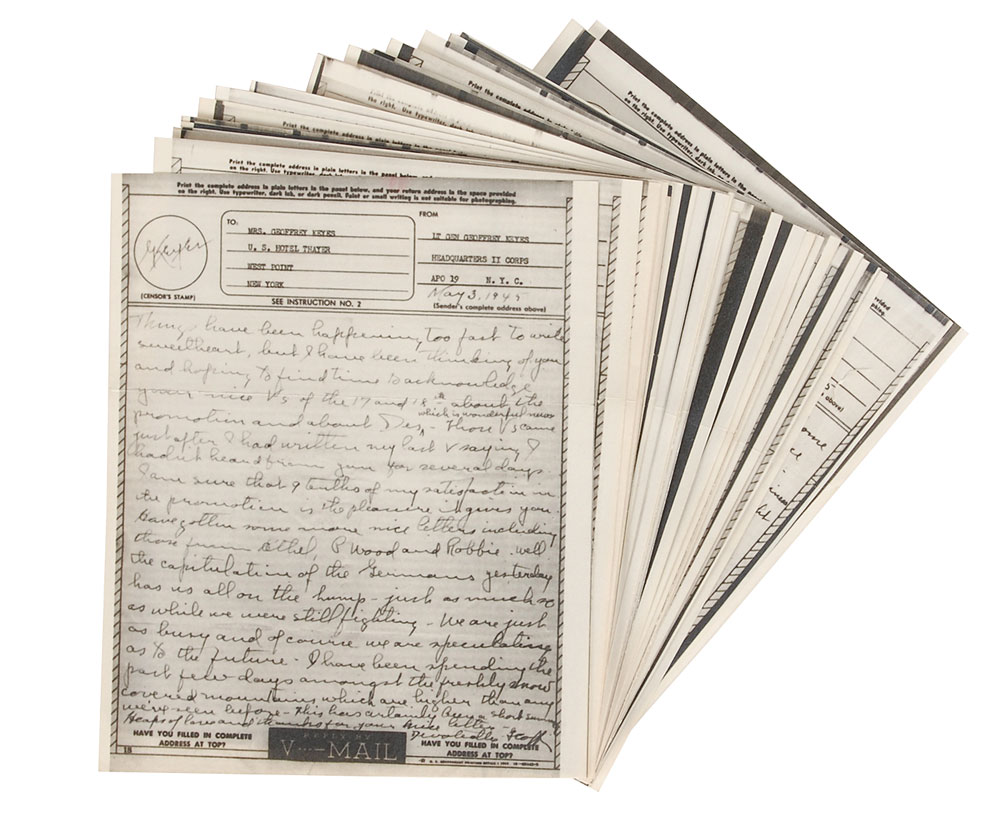
Large hand-colored and annotated map of western Germany, 22 x 29, dated June 4, 1945, from the collection of Lieutenant General Geoffrey Keyes. The map is entitled “Administrative Map, Western-Germany,” and was printed by the 649th Engineer Topographic Battalion in Waiblingen-bei-Stuttgart. The landkreise, stadtkreis, and land boundaries are noted. Identified with flags are three Region Headquarters (Darmstadt, Marburg, Stuttgart) and five R.B. Headquarters (Frankfurt, Kassel, Wiesbaden, Mannheim, Karlsruhe). In very good to fine condition, with central vertical and horizontal folds, tack holes to corners, and light overall creasing. Accompanied by 25 pages of V-Mail from Lieutenant General Keyes to his wife, May–August 1945. The Berlin Declaration of June 5, 1945, confirmed the division of Allied-occupied Germany into four occupation zones according to the Yalta Conference. From the estate of Lieutenant General Geoffrey Keyes.