Sold For $2,330
*Includes Buyers Premium
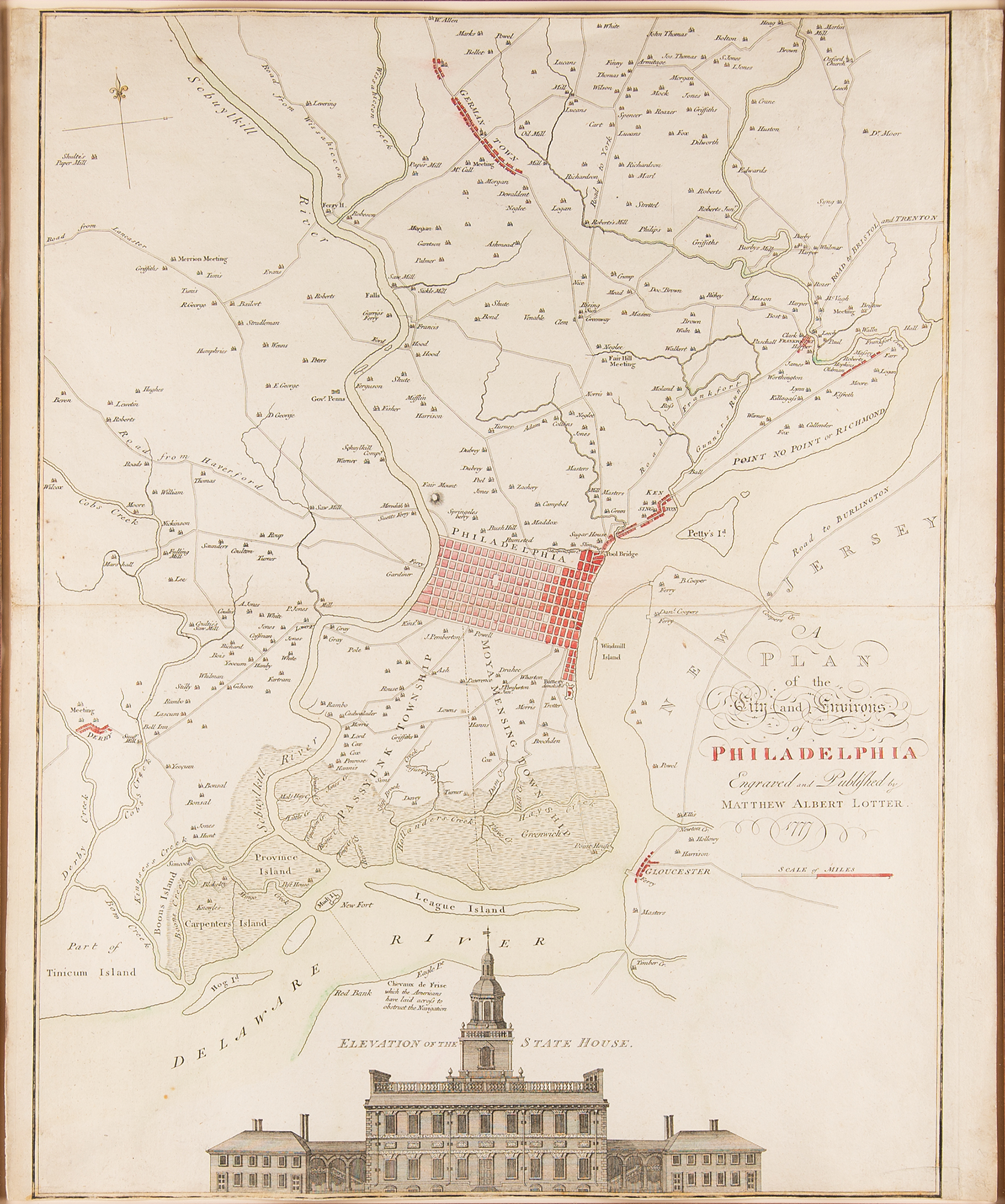
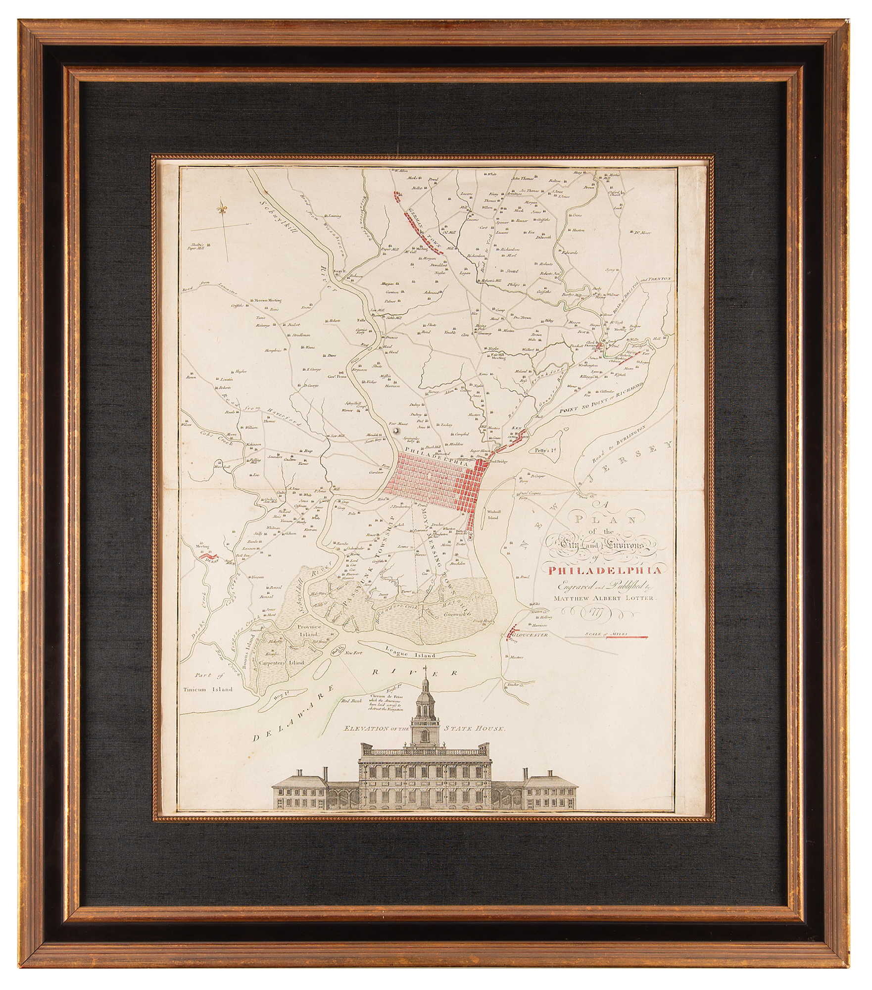
Stunning hand-colored map entitled "A Plan of the City and Environs of Philadelphia," engraved and published by Matthew Albert Lotter in 1777, measuring 19.5 x 23.5, a Revolutionary War–era reissue of the famous 'Scull and Heap' plan of 1752. The large map centers on Thomas Holme's 1682 urban grid plan for the city, situated between the Schuylkill and Delaware Rivers, with numerous outlying 'county seats' placed and named, and the city's primitive road system indicated. A detailed engraving of the Pennsylvania State House—today known as Independence Hall, where the Declaration of Independence was signed in 1776—features at the bottom of the plan. Gorgeously cloth-matted and framed to an overall size of 29.5 x 34. In fine condition.