Sold For $963
*Includes Buyers Premium
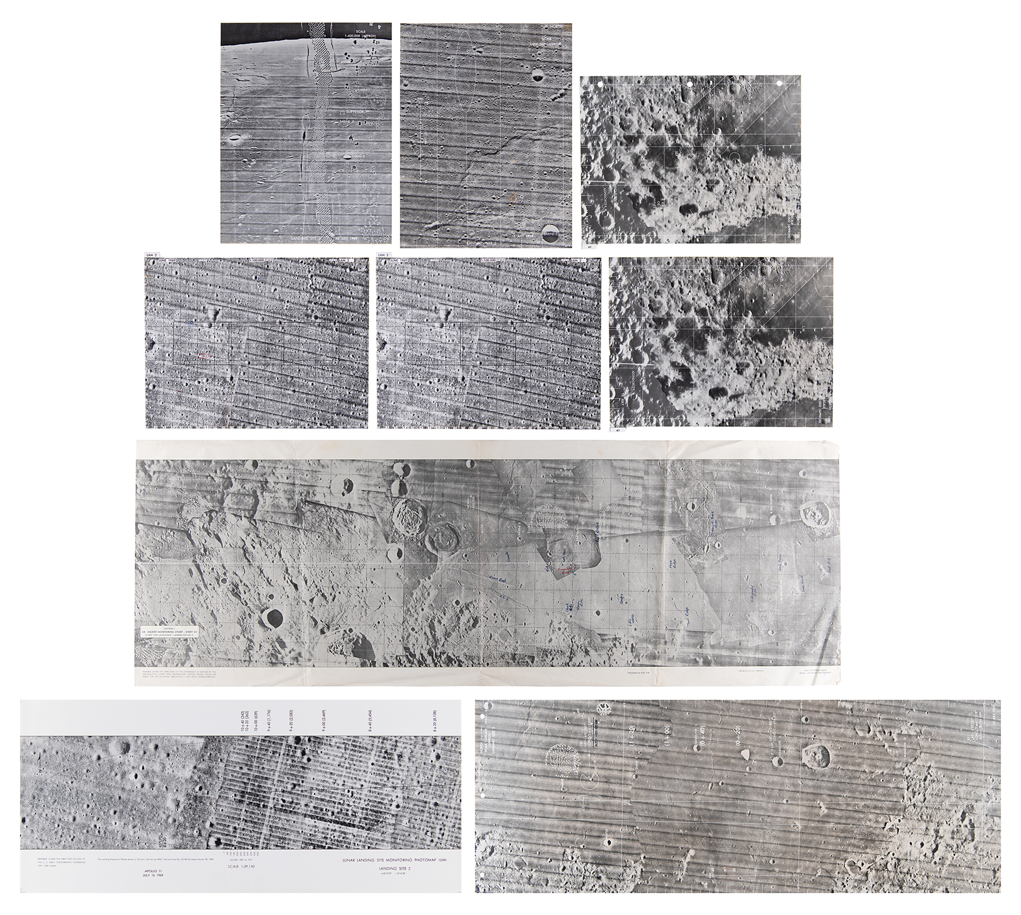
Collection of eight Apollo 11 lunar surface maps printed on chronopaque, plus a paper ascent monitoring chart, all originating from the collection of a NASA engineer. The maps include:
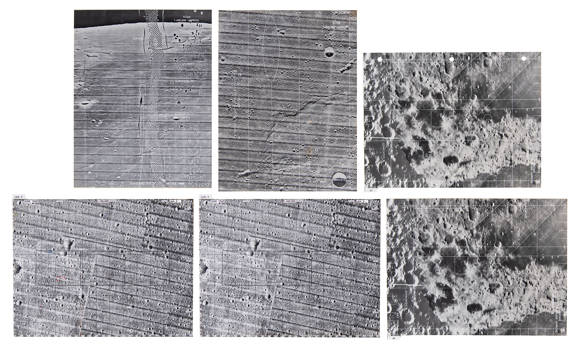
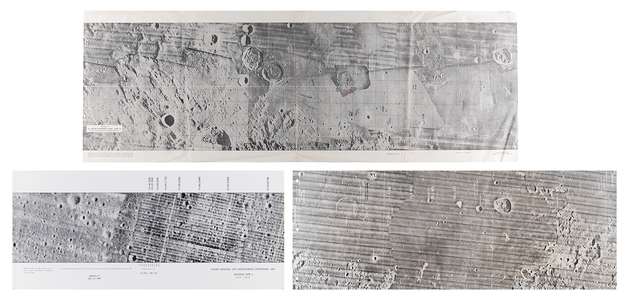
- a 20 x 9 chronopaque map labeled "Lunar Landing Site Monitoring Photomap (LLM), Landing Site 2, Apollo 11, July 16, 1969," featuring a 1:39,140 scale image of the final landing site area in the southwestern Mare Tranquillitatis ('Sea of Tranquility').
- a 28 x 10.5 chronopaque chart labeled "Landing Site 2, 16 July 1969," featuring a 1:630,000 scale image of the 'Sea of Tranquility' landing site.
- six 8 x 10.5 chronopaque pages with images of the lunar surface, identified as "LAM 2" (2), "Landing Site 2" (2), and "A1" (2).
- a first edition 35.5 x 12.5 paper first edition "LM Ascent Monitoring Chart—Sheet 3B," featuring mapping images of Apollo 11 Landing Site 2, annotated in the hand of NASA engineer Milton J. 'Jack' Neubauer, Jr., identifying numerous landmarks including "Little Motke," "Cat's Paw," "Faye Ridge," "Diamond Back Rille," "Sidewinder Rille," "Thud Ridge," and more.
In overall very good to fine condition, with folds, wear, and creases to the paper ascent chart; the chronopaque maps are in fine condition.
From the estate of NASA engineer Milton J. "Jack" Neubauer, Jr