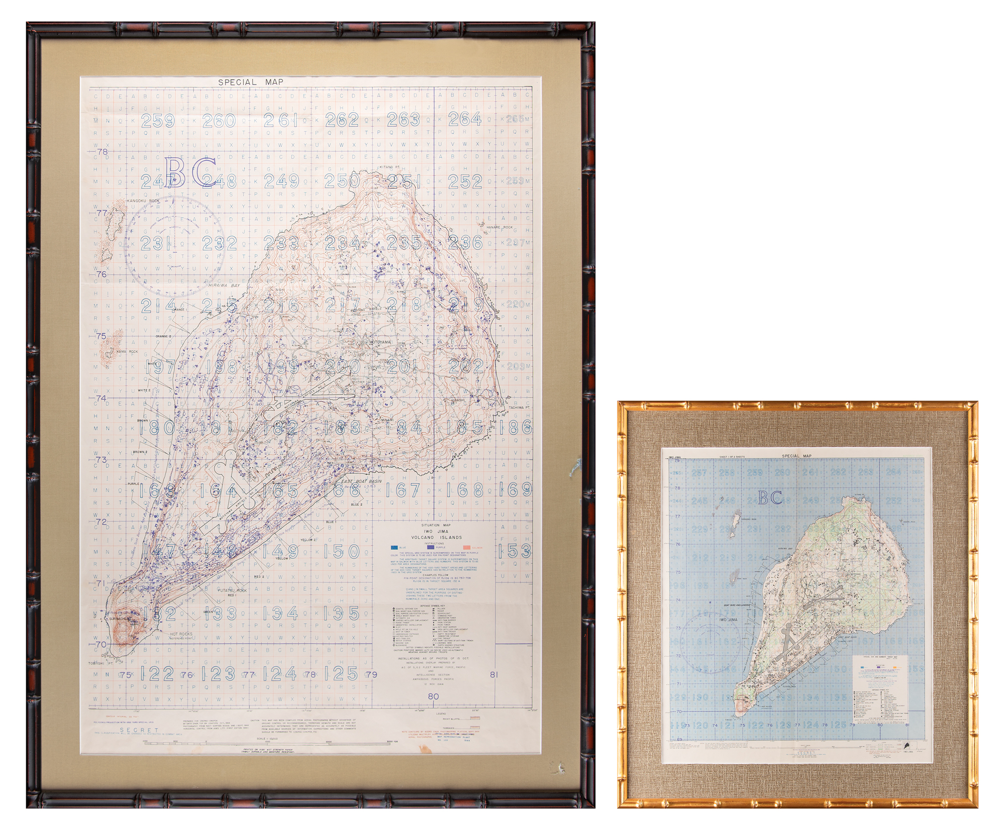
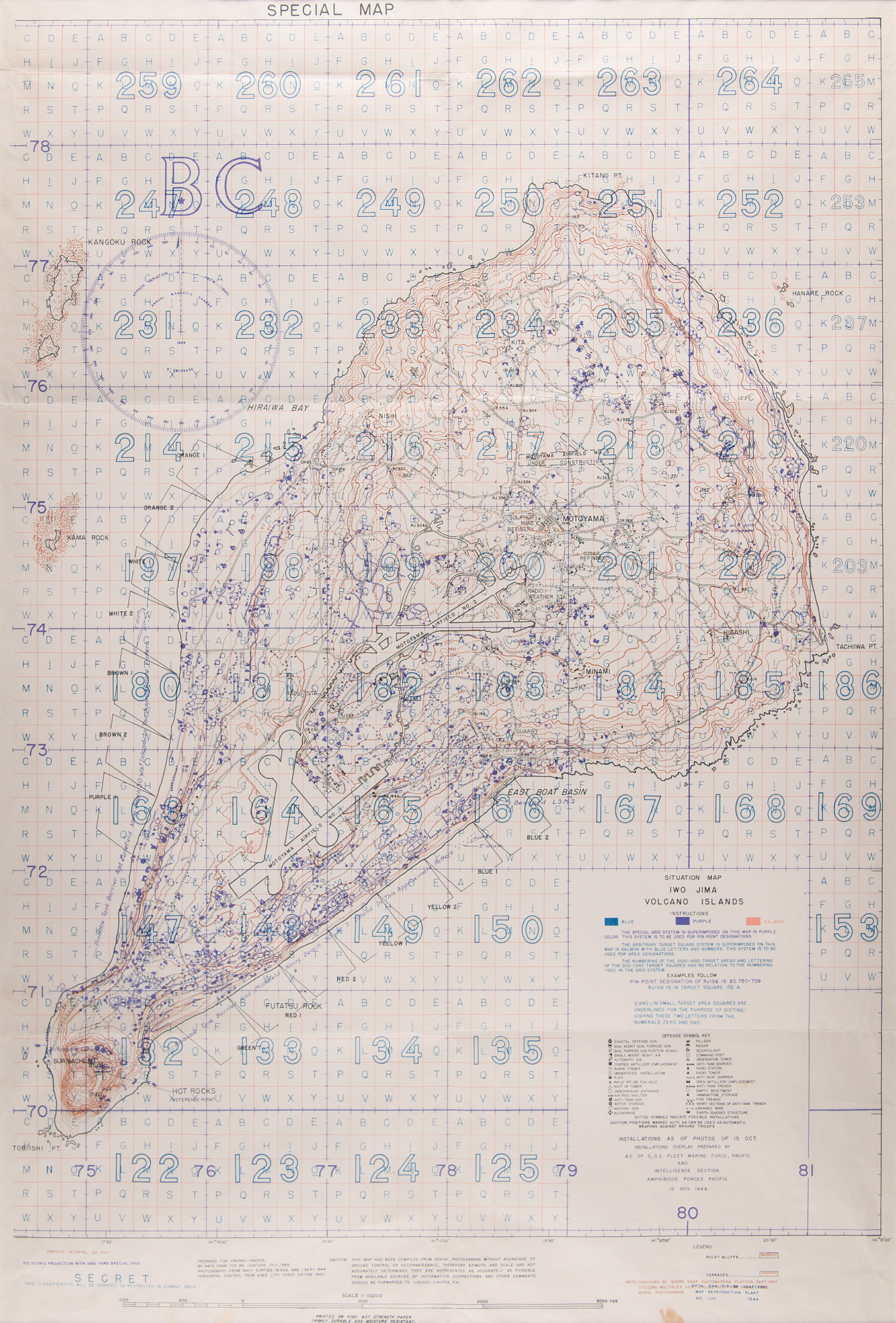
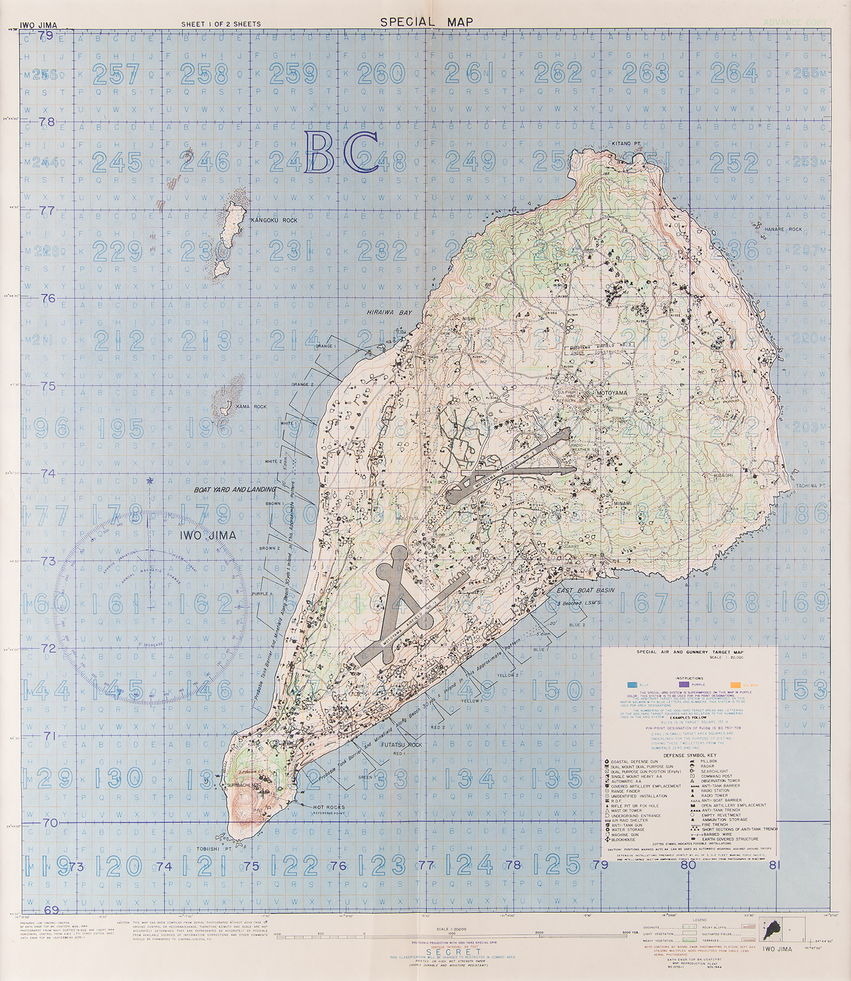
Impressive pair of uncommon World War II-dated ‘Special Maps’ of Iwo Jima designed for high-ranking members of U.S. naval forces in the Pacific theater. Both were prepared for CINPAC-CINCPOA [Commander in Chief, Pacific Fleet - Commander in Chief, Pacific Ocean Areas] by 64th Engr. Top. Bn. USAFICPA in October and November 1944, respectively, and feature the interesting “Caution” note: “This map has been compiled from aerial photographs without advantage of ground control or reconnaissance; therefore azimuth and scale are not accurately determined." The two color maps, an advance copy of "Special Air and Gunnery Target Map" and a "Special Situation Map,” both marked “Secret,” measure 17.5 x 20 and 27 x 39.5 and are 1:10,000 and 1:20,000 scale.
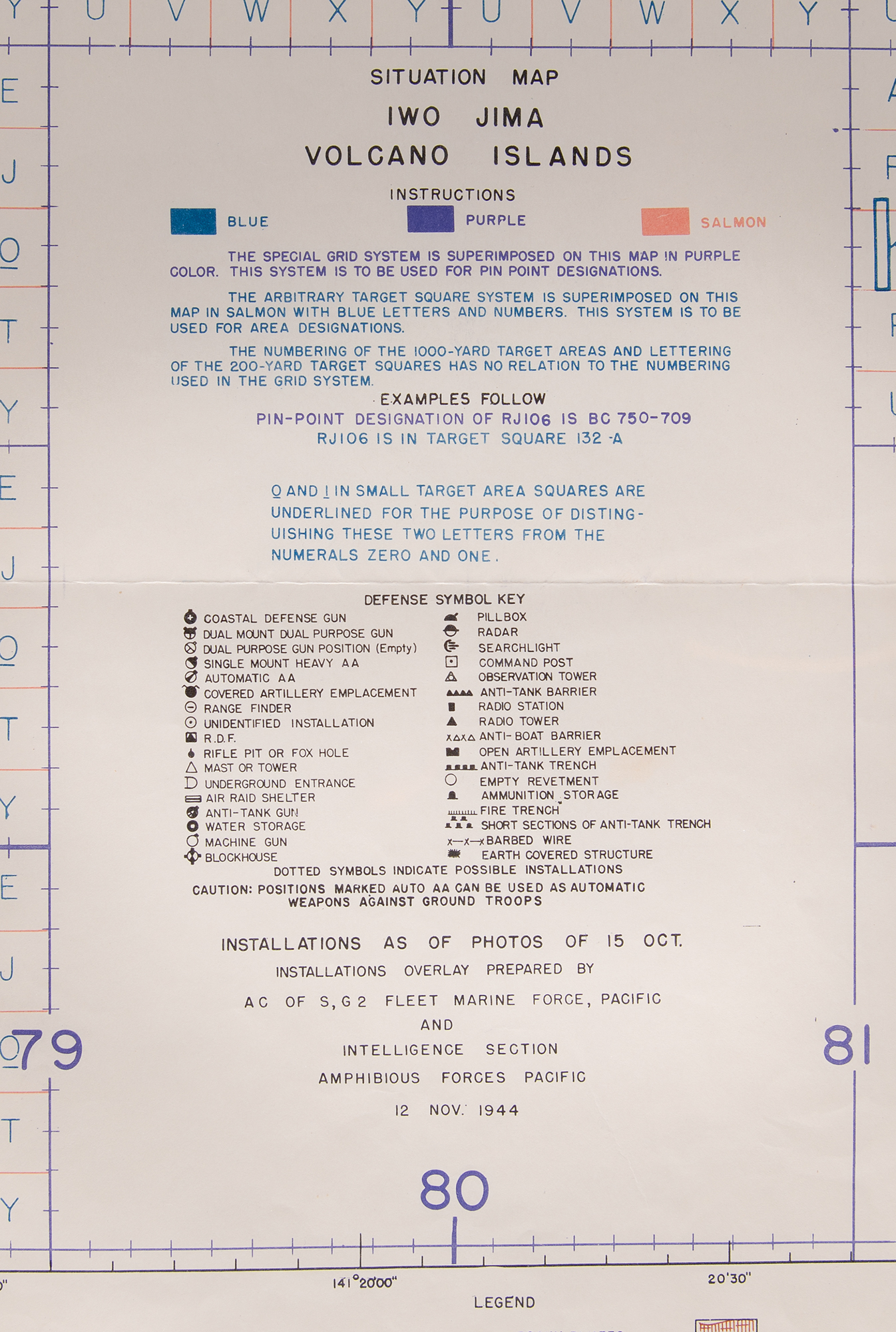
These highly detailed maps identify dozens of Japanese defense sites, using symbols described in a "Defense Symbol Key," including coastal defense guns, anti-aircraft guns, foxholes, anti-tank guns, machine guns, water storage, blockhouses, radar, searchlights, observation towers, anti-tank trenches, radio towers, ammunition storage, command posts, and other structures, obstacles, and military installations. The maps are individually matted and framed to overall sizes of 23.5 x 26 and 33.5 x 46. In overall fine condition, with intersecting folds as issued, and a small stain to the bottom edge of the larger ‘Situation’ map.
Provenance: The World War II 70th Anniversary Sale, Bonhams, April 29, 2015, noting the provenance as Commander Michael Malanaphy.
These maps demonstrate the intensive effort that went into planning the American invasion of Iwo Jima, which would begin three months later on February 19, 1945. In spite of some knowledge of the island's heavy fortifications—more than 30 distinct symbols representing the Japanese Army's positions are used here—the density and capability of the Japanese defenses were still severely underestimated, resulting in some of the fiercest and bloodiest fighting of the Pacific War. Interestingly, these maps project troop landings for the western and southeastern sides of the island: ultimately, only the southeastern landing zones were used by the Marines.
We use cookies on this site to improve your experience. By using this site, you accept our use of cookies. To learn more, please see our Privacy Policy.