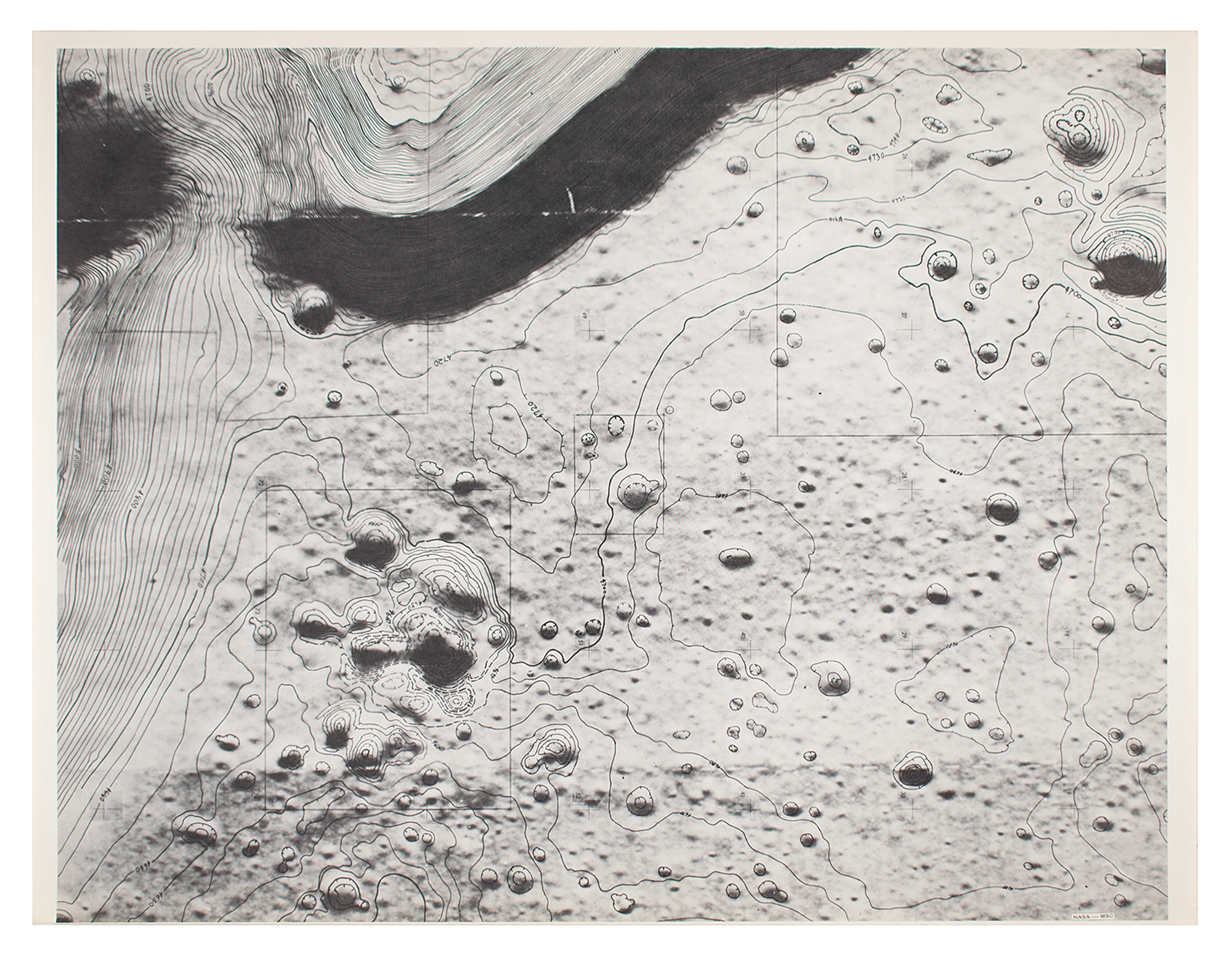
Scarce internal NASA/MSC shaded relief topographic landing site chart for the Apollo 15 mission, 22 x 17, featuring contour lines that give elevation of the terrain and surrounding mountains of the Hadley-Apennine region, with the Hadley Rille visible in the upper right section. In fine condition.
We use cookies on this site to improve your experience. By using this site, you accept our use of cookies. To learn more, please see our Privacy Policy.