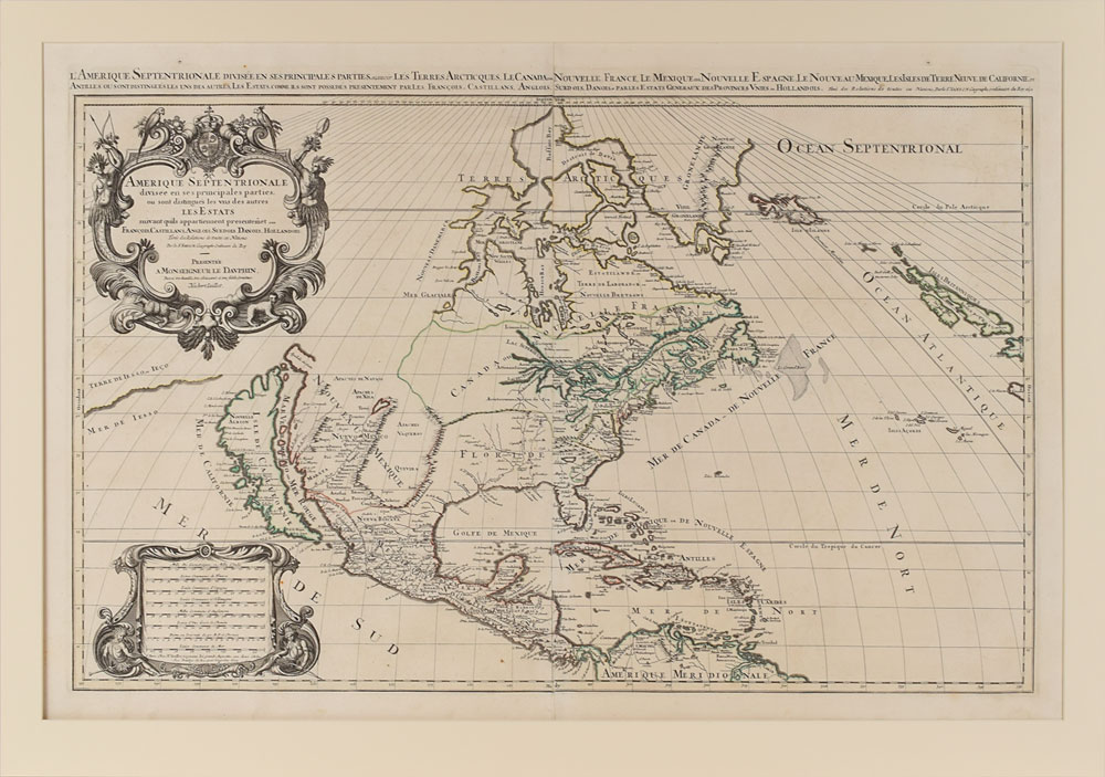
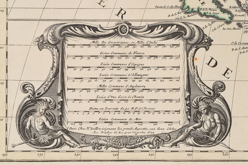
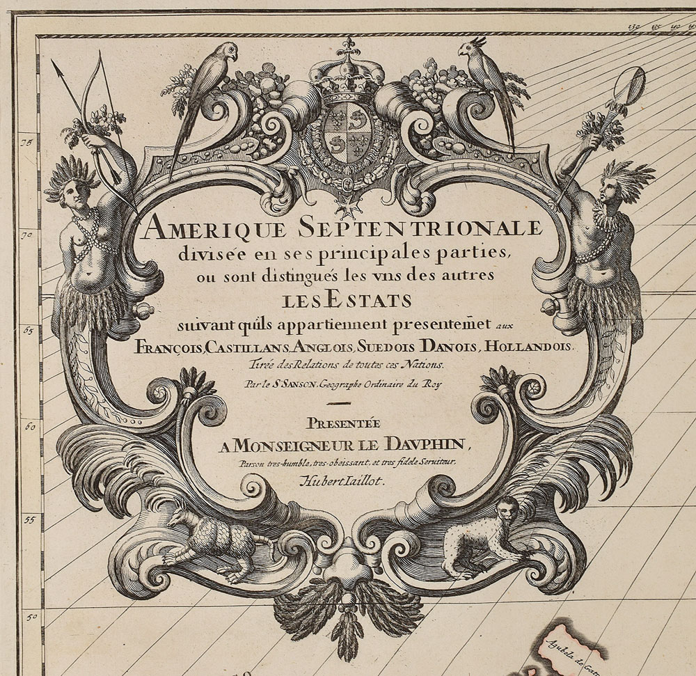
Magnificent 1692 map of North America published by Alexis Hubert Jaillot after Nicholas Sanson, 36 x 24, entitled “Amerique Septentrionale, Divisee en ses Principales Parties, ou sont Distingues les Uns des Autres les Estats Suivant qu'ils Appartiennet Presentemet aux Francois, Castillans, Anglois, Suedois, Danois, Hollandois.” The decorative title cartouche to the upper left is adorned with the French coat of arms, two Native Americans, and tropical birds atop; the distance scale cartouche to lower left is dated 1692 in the last line. Border outlines are hand-colored. Matted to an overall size of 39 x 27.5. In fine condition.
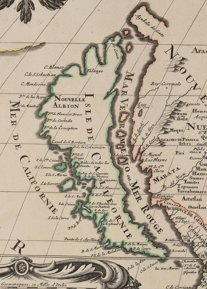
One of the most famous cartographic errors in history, this map portrays California as an island off the coast of Mexico. It correctly depicts the five Great Lakes, though Superior and Michigan are open-ended, and the western part of the continent is a vast unexplored territory. What is today the United States is largely divided between “Canada ou Nouvelle France,” “Floride,” and “Nouveau Mexique.” A simply remarkable, beautiful map of the ‘New World’ from the two hundredth anniversary of its discovery.
We use cookies on this site to improve your experience. By using this site, you accept our use of cookies. To learn more, please see our Privacy Policy.