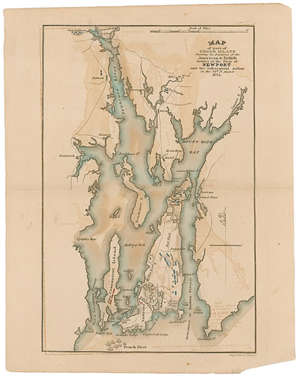
Hand-colored map fully entitled “Map of Part of Rhode Island showing the positions of American and British Armies at the Siege of Newport and the subsequent action on the 29th of August 1778,” 8 x 10.25, with “Engraved by J. Yeager,” printed in the lower border. Map shows the Rhode Island coast, encampments, the British Line near Newport, and General Lafayette’s position near Barrington. Tape repair to reverse of a complete separation along central horizontal fold, uniform toning, paper loss to lower right corner, and mirroring of map from folding, otherwise very good condition. RRAuction COA.