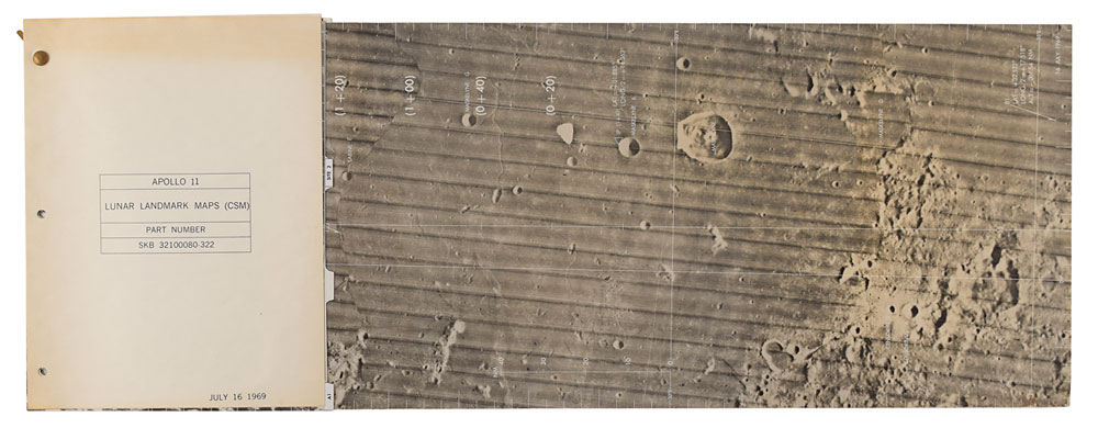
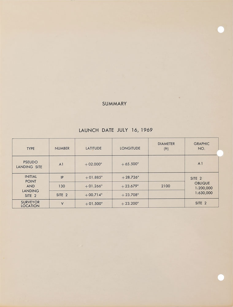
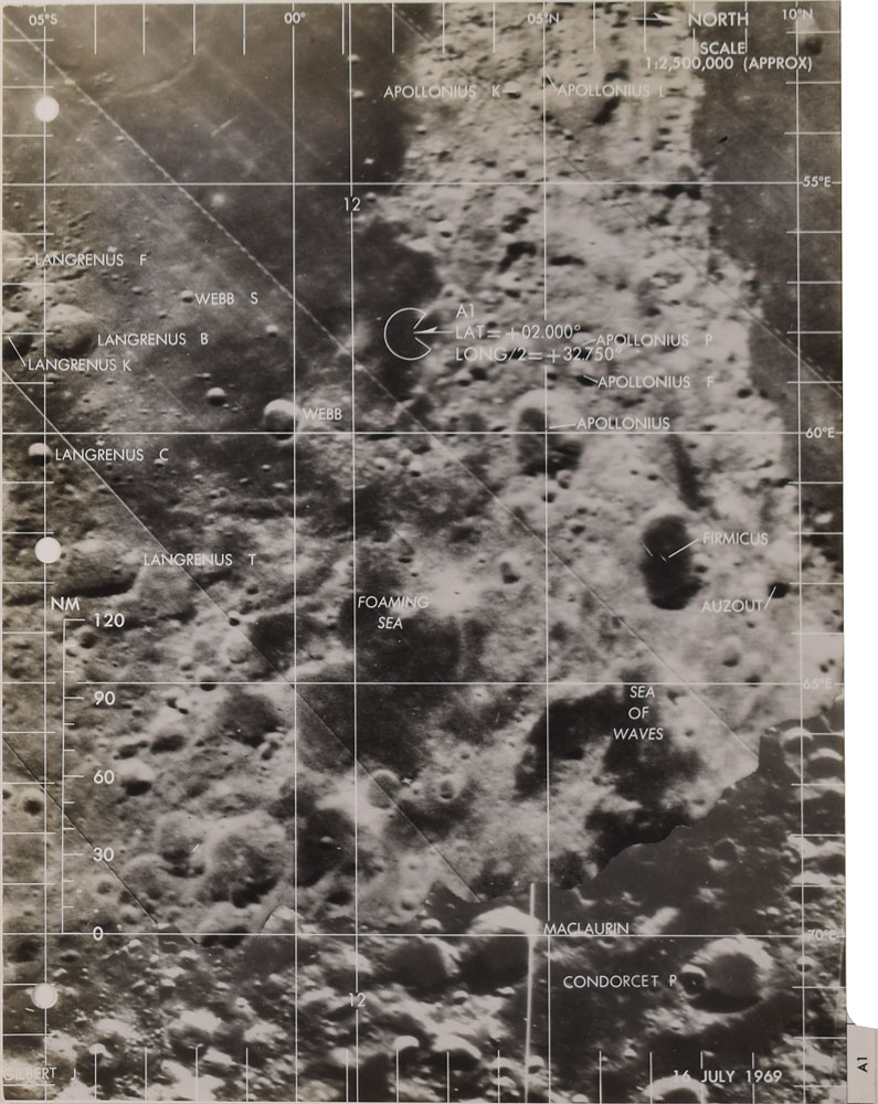
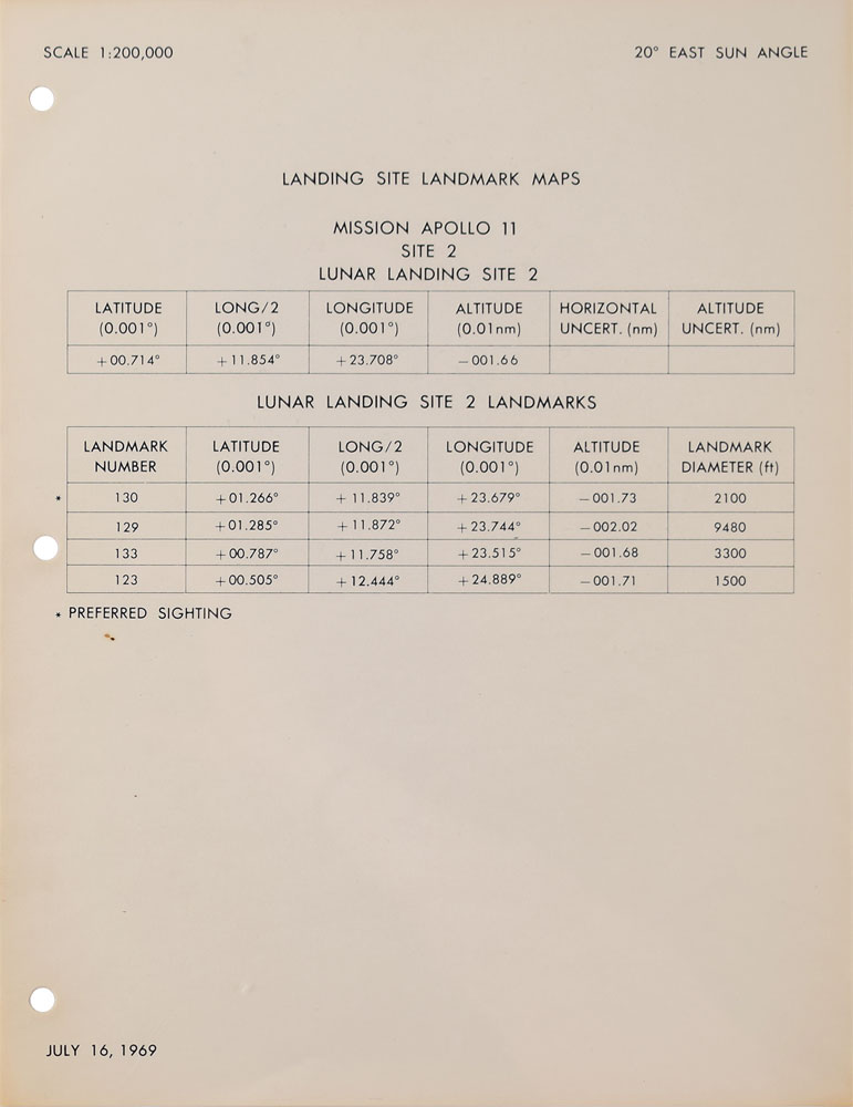
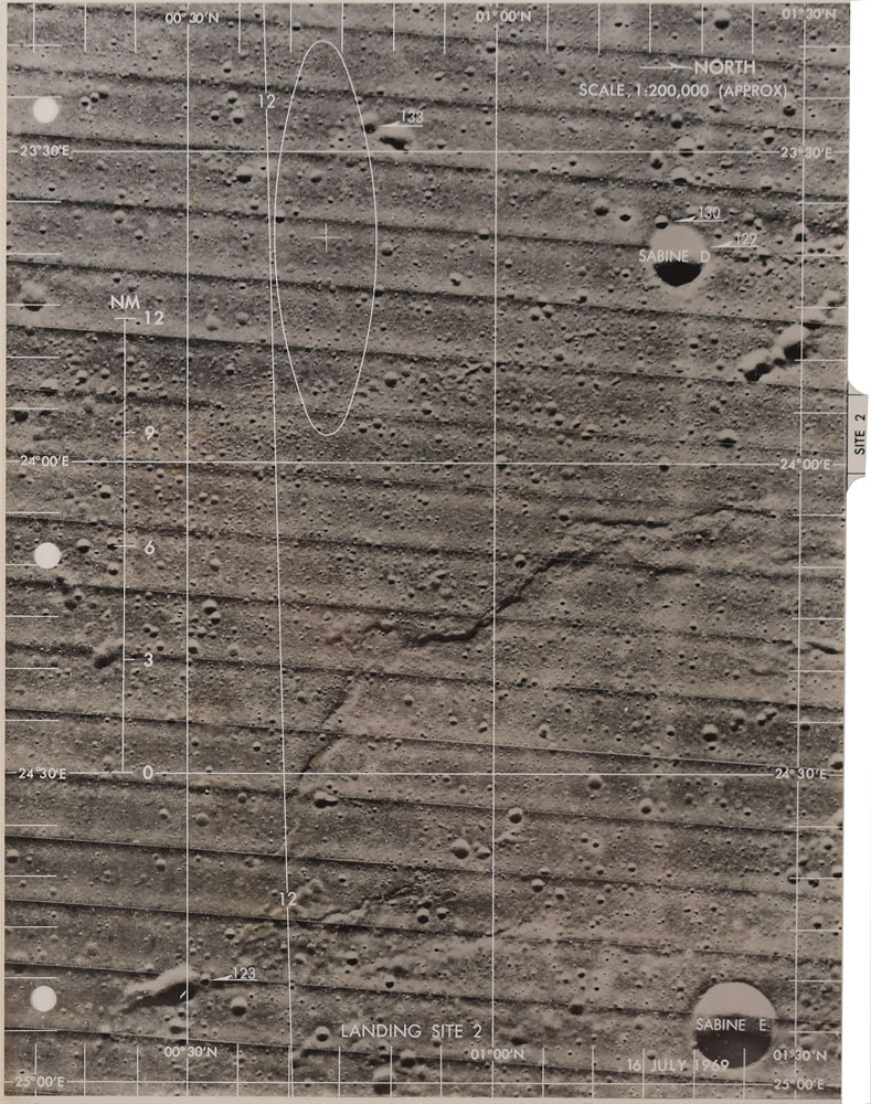
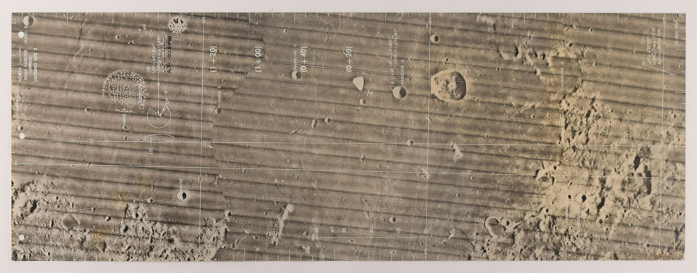
Packet of Apollo 11 lunar landmark maps , comprising five photographic map plates with interleaved info sheets, and a cover sheet labeled: "Apollo 11, Lunar Landmark Maps (CSM), Part Number SKB 32100080-322, July 16, 1969." Four of the plates measure 8 x 10.5, and one panoramic plate measures 28 x 10.5: the first shows the "A1" pseudo landing site used for tracking purposes, and the four others (including the large panorama) show "Landing Site 2" in the Mare Tranquillitatis, or 'Sea of Tranquility,' where Apollo 11 successfully landed. Among the landmarks identified in the maps are craters (Moltke, Maskelyne, Langrenus, Webb, Apollonius, Sabine, and others), various regions (Foaming Sea and Sea of Waves), and the Surveyor V landing site. Bound together in the upper left with a brass brad. In fine condition, with some waviness to the large panoramic map plate. From the Don Eyles Apollo Computer Collection.
We use cookies on this site to improve your experience. By using this site, you accept our use of cookies. To learn more, please see our Privacy Policy.