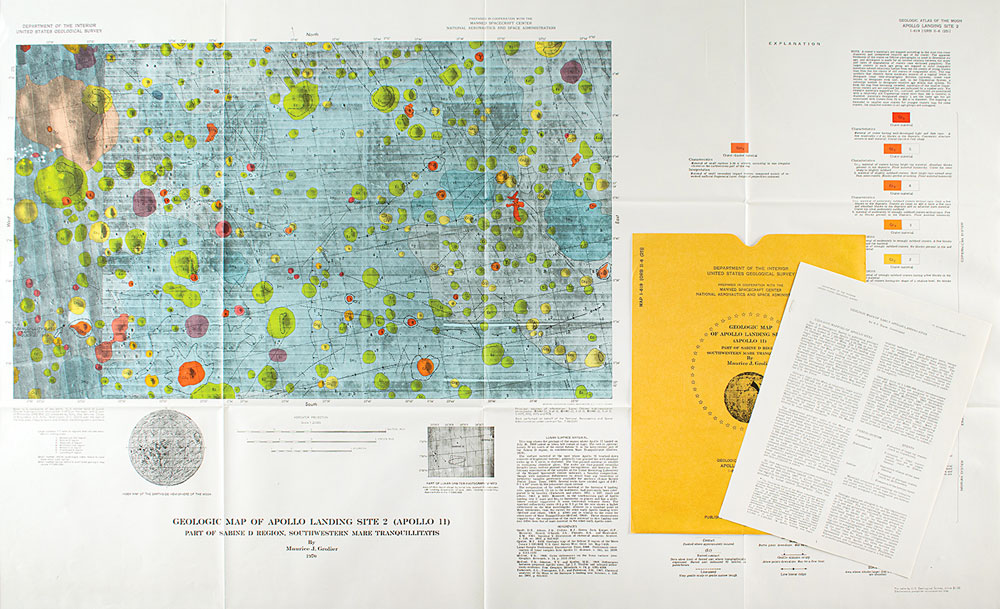
Desirable Apollo 11 geological map of the Sabine D region, southwestern Mare Tranquillitatis of the moon by Maurice J. Grolier, published by the US Geological Survey in 1970. The 1:25,000 scale map, 41″ x 24″, entitled “Geologic Map of Apollo Landing Site 2 (Apollo 11),” shows the lunar surface east of Tranquility Base with multicolored circles indicating various mare and crater material. A section marked “Lunar Surface Material,” in part: “This map shows the geology of the region where Apollo 11 landed on July 20, 1969 (arrow in lower left corner of map). The site is approximately 20 km south of the crater Sabine D, in the west-central part of the Sabine D region, in southwestern Mare Tranquillitatis.” Includes the original Department of the Interior, United States Geological Survey (Map I-619) storage folder and the stapled 4-page information packet. In fine, folded condition, with a tiny tear to bottom edge of folder. The Sabine D crater was later renamed the Collins crater in honor of Apollo 11 Command Module Pilot Michael Collins. Located about 25 kilometers to the north of the Apollo 11 landing site, Collins is a tiny lunar impact crater located on the southern part of the Mare Tranquillitatis, the Sea of Tranquility.
We use cookies on this site to improve your experience. By using this site, you accept our use of cookies. To learn more, please see our Privacy Policy.