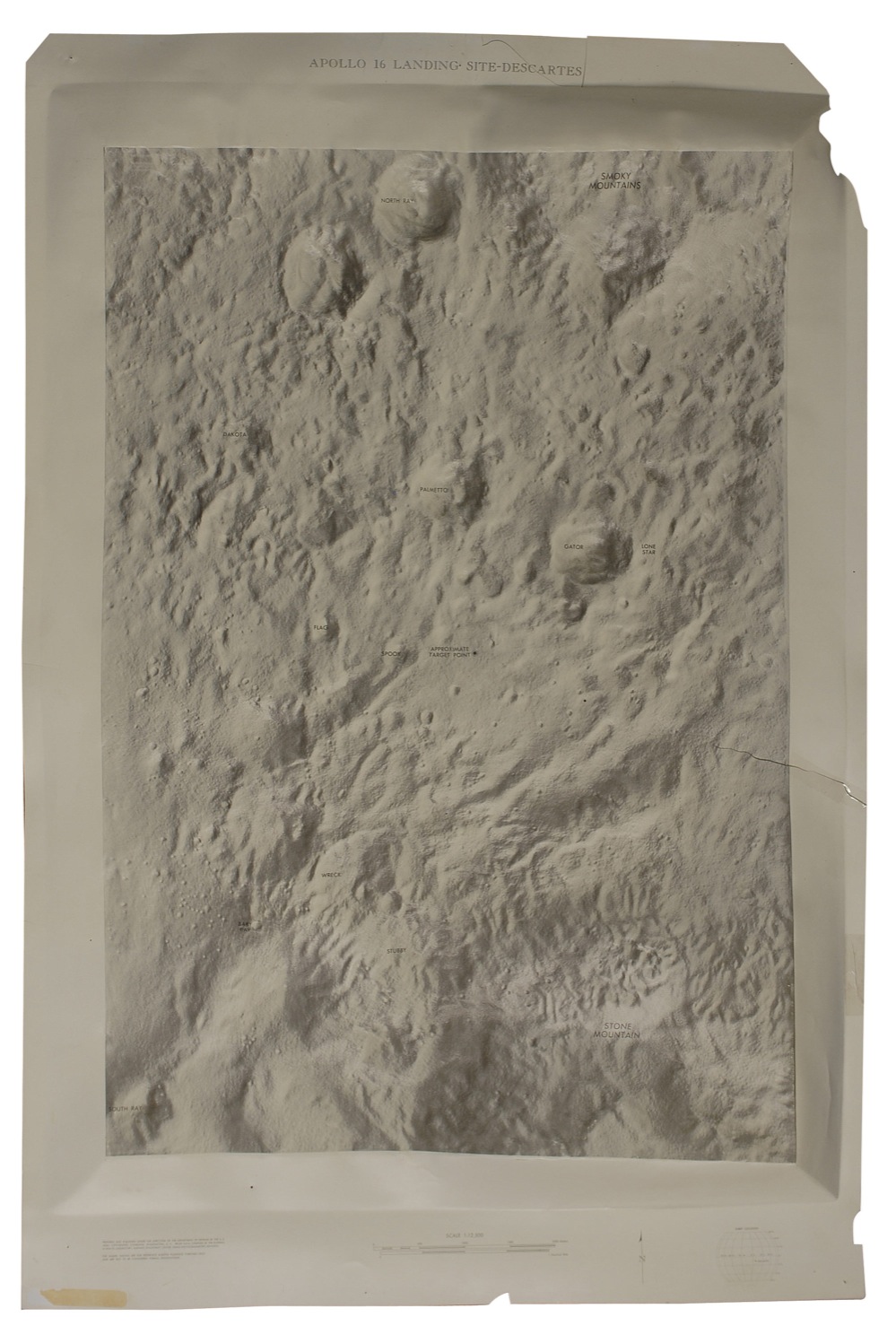
A rare Apollo 16 topographic plastic model taken from the LM simulator surface model used to train the astronauts. Map measures 29 x 44, and is of their actual landing site, Descartes. This 1:12,500 map shows the target site near the center, and other lunar landmarks labeled include Smoky Mountains, Stone Mountain, Spook, Gator, and Baby Ray. Legend at the bottom gives the longitude and latitude of the landing site, and states the map is “prepared and published under the direction of the Department of Defense by the US Army Topographic Command.” Accompanied by a letter of authenticity from NASA Crew Station Subsystem Manager for the Lunar Module George Franklin providing background information on the use of the simulator, and attesting this model was taken from the simulator surface model. In part: “This model was molded from the simulator lunar surface model. The simulator lunar surface model was approximately 20 feet by 40 feet…an optical probe was attached to a scaled LM along a thrust axis…Each flight, beginning with Apollo 10, had its own particular lunar surface model…The simulator was programmed to fly the auto flight trajectory, beginning with the powered descent initiation…The crew monitored the visual display during this final phase and when the time for landing approached, then took over and flew to a crew selected landing.” He closes the letter by stating “This author was the Crew Station Subsystem Manager for the Lunar Module from 1963 through the end of the Apollo program. I was responsible for all the crew interfaces in the cabin as well as providing integration engineering for the flight crews. My activities included working with the procedures personnel, simulator interfaces, other system engineers, mission planning, mockup development and other crew training activities.” Map is fragile and has several repaired and unrepaired cracks, tack holes, and edge chips. Only a few known copies of lunar landing site topographical maps are known to exist, with even fewer available for public sale. RRAuction COA.
We use cookies on this site to improve your experience. By using this site, you accept our use of cookies. To learn more, please see our Privacy Policy.