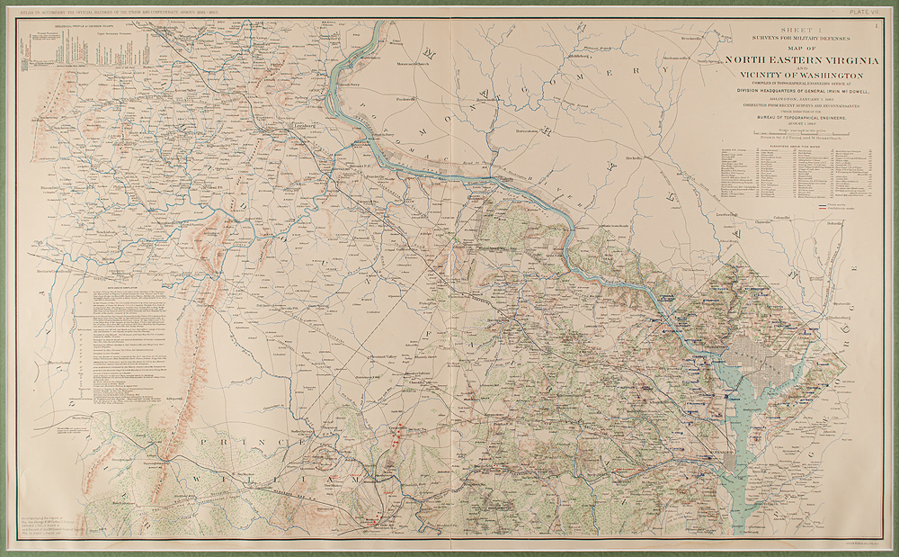
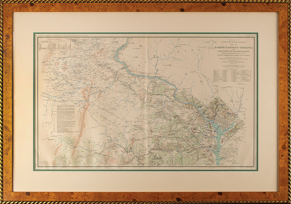
Attractive circa 1892 color Civil War map entitled “Surveys for Military Defenses Map of North Eastern Virginia and Vicinity of Washington,” 27.75 x 17, issued as Plate VII, Sheet 1, and published by Julius Bien & Co. of New York. This highly detailed map, drawn by J. J. Young and W. Hesselbach, extends from Washington D.C. and Fairfax County to Loudoun, Prince William, and Fauquier Counties, and shows both Union and Confederate works, in addition to numerous towns, roads, turnpikes, rivers, lakes, churches, meeting houses, railroads, hospitals, surveys, elevations, and a host of other details. The upper right corner notes that the map was “Compiled in Topographical Engineers Office at Division Headquarters of General Irvin McDowell.” The map was issued to accompany the monumental “Atlas to Accompany the Official Records of the Union and Confederate Armies. 1861-1865,” which stands as the most comprehensive compilation of maps of the Civil War. Handsomely and professionally matted and framed to an overall size of 36.5 x 25.5. In fine condition, with light rippling, and a central vertical fold.
We use cookies on this site to improve your experience. By using this site, you accept our use of cookies. To learn more, please see our Privacy Policy.