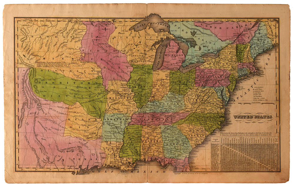
Uncommon color 18.75 x 11.75 map of the United States from the ‘Huntington's School Atlas, Drawn and Engraved Expressly to Illustrate and Accompany the System of Modern Geography,” published by Nathaniel G. Huntington in 1833. This early map of the United States stretches to the Rocky Mountains and shows Texas as a part of Mexico. A large Missouri Territory covers the middle of the country and is filled with Indian districts including the Sioux, Mandan, Osage and Ozark tribes. Wisconsin is shown as "Attach’d to Michigan.” The map of America also shows Mexico in control of the Southwest and the US border with Canada extends well into British Columbia, reflecting the American government’s interest in the region. In fine condition, with tape repairs to splitting at the ends of the central vertical fold.
We use cookies on this site to improve your experience. By using this site, you accept our use of cookies. To learn more, please see our Privacy Policy.