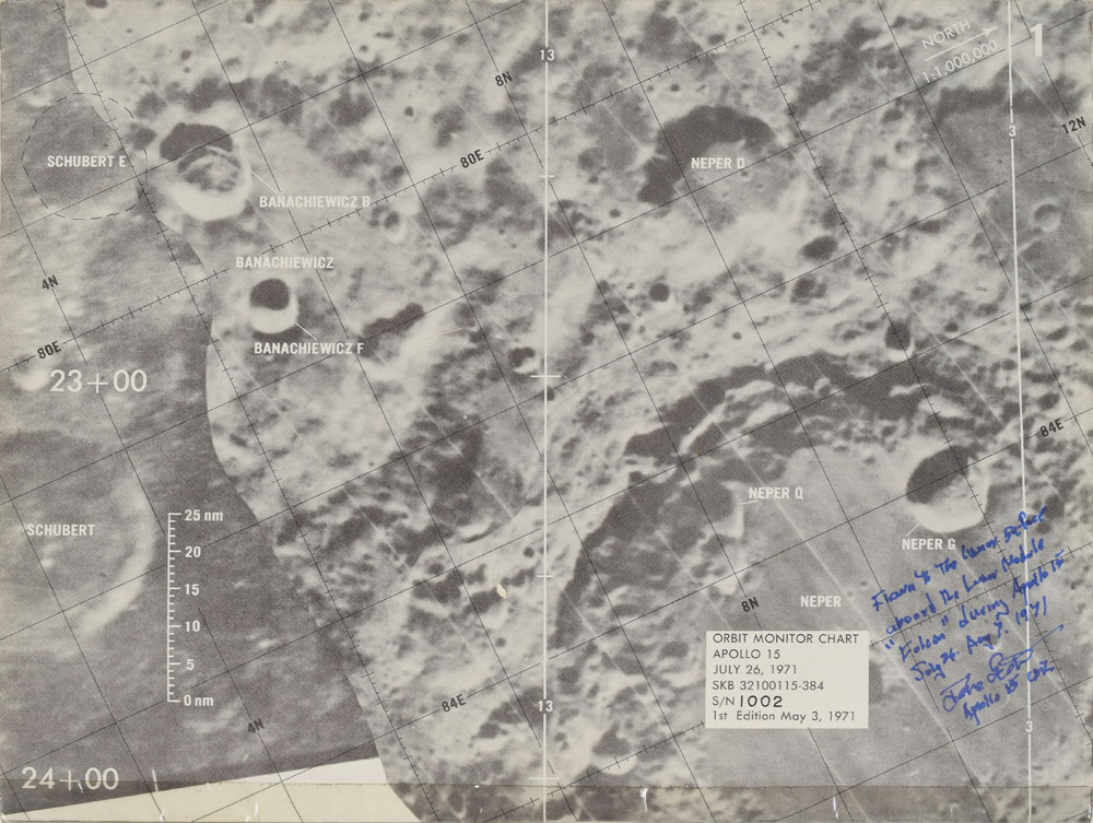
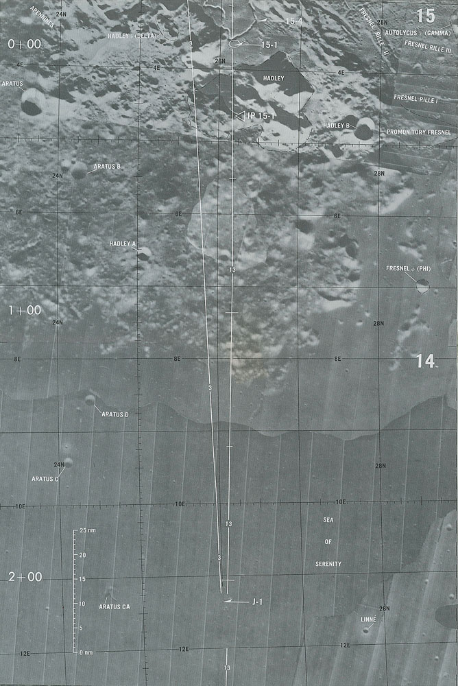
Dave Scott’s flown lunar orbit monitor chart carried to the moon during the Apollo 15 mission, folded to 10.5 x 8, signed and flight-certified on the first plate in blue felt tip, “Flown to the lunar surface aboard the Lunar Module 'Falcon' during Apollo 15, July 26-Aug 7, 1971, Dave Scott, Apollo 15 CDR." The chart is comprised of 18 map plates taped together at the center, which if detached and unfolded would measure over 12 feet long. The chart was used for lunar landmark identification while in orbit and is labeled on the first panel, “Orbit Monitor Chart, Apollo 15, July 26, 1971, SKB 32100115-384, S/N 1002, 1st Edition May 3, 1971." The landing site near Hadley rille is shown on panel 15. In fine condition. From the personal collection of Dave Scott.
Accompanied by a signed letter of authenticity from Scott, in part: "I hereby certify that the Apollo 15 Lunar Module 'Orbit Monitor Chart' (OMC) is from my personal collection and was flown aboard the Lunar Module Falcon during Apollo 15...This chart was used in lunar orbit...for lunar landmark identification and verification of LM positions above the surface (groundtrack) prior to the lunar landing. It consists of 18 numbered printed B&W photographic panels, each 10.5″ x 8″, all taped together to provide a continuous map. Each panel shows approximately 5500 square miles of the moon's surface, the total area of the maps covers the sunlit portion of the near-side of the Moon prior to descent and landing. An example of the information provided can be illustrated in panel 1 (containing the legend box). The Apollo 15 site was located on the Moon at 26 deg N, 4 deg E. Therefore as the Moon rotated under the A-15 orbit, the ground track moved from North to South, that is the ground track moves SSE due to the inclination of the orbit at 25 deg north. The groundtrack for certain revolutions is shown on the maps as vertical white lines...The left side of the panel shows the countdown in minutes (as the LM flies from east to west) prior to reaching the orbital position over the landing site (Panel 15), after which the count increases in minutes up until reaching the eastern edge (limb) of the Moon. Longitude and latitude are shown numerically and in black lines on each panel. A scale of distance on the surface (in nautical miles) is shown on the left of the panel...This LM 'Orbit Monitor Chart' (OMC) has been in my personal collection since NASA presented it to me upon our return to Earth." An impressive and important flown piece.

This item is Pre-Certified by STEVE ZARELLI
Buy a third-party letter of authenticity for
$25.00
*This item has been pre-certified by a trusted third-party authentication service, and by placing a bid on this item, you agree to accept the opinion of this authentication service. If you wish to have an opinion rendered by a different authenticator of your choosing, you must do so prior to your placing of any bid. RR Auction is not responsible for differing opinions submitted 30 days after the date of the sale.
We use cookies on this site to improve your experience. By using this site, you accept our use of cookies. To learn more, please see our Privacy Policy.